
Guess what? Another townland called Balloo. That makes three so far. Today’s townland is Balloo Lower, on the coast east of Groomsport.  The Lower Balloo Road goes up and down over drumlins (and yes that’s a distant view of Scrabo tower).
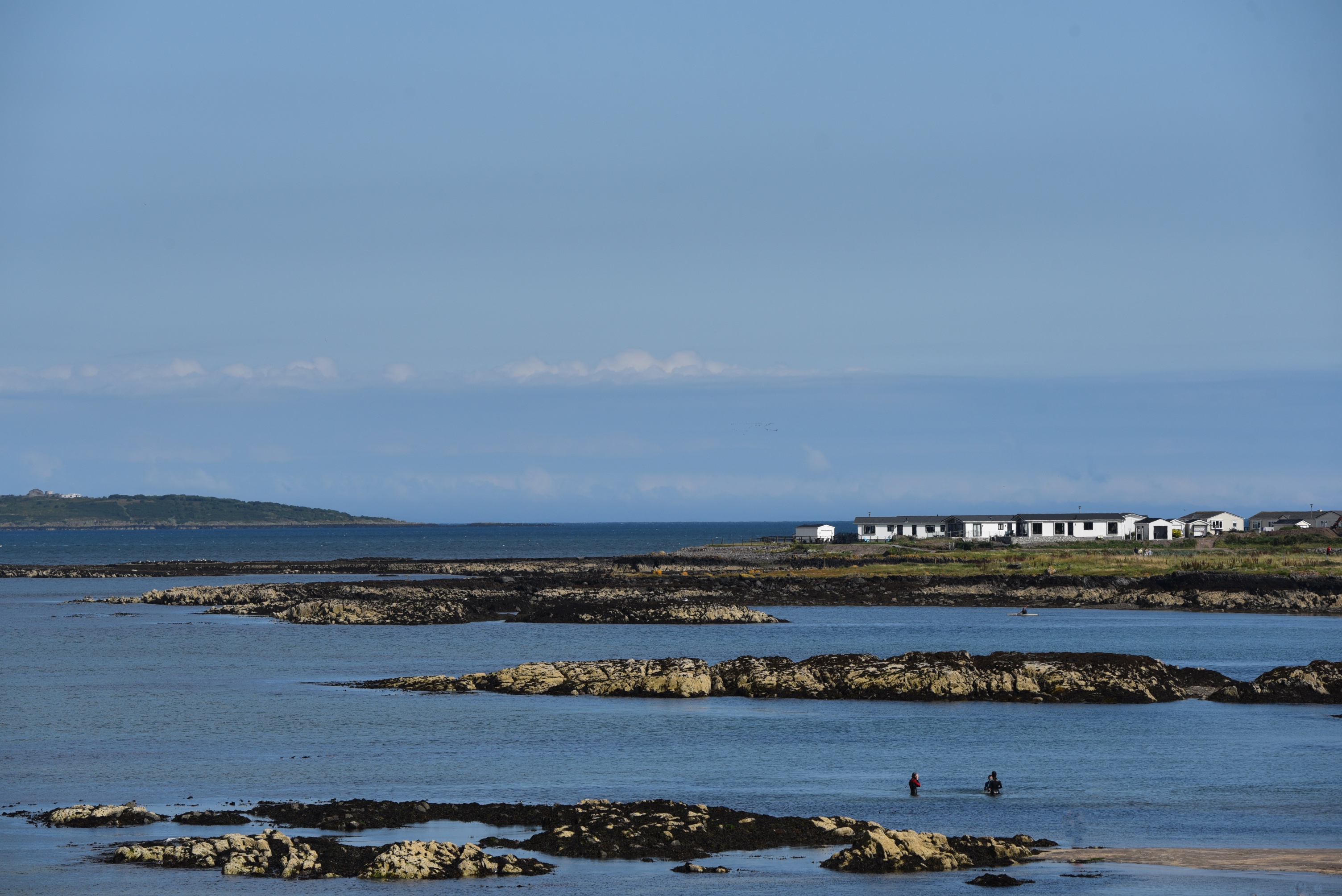
 Reaching the shore at Groomsport, the townland of Balloo Lower doesn’t go into the village, but instead extends across quiet bays and the Windsor Holiday park, with easy access for walkers along the North Down Coastal Path.
 I could see the Copeland Island bird observatory further out to sea, so I looked around for birds and found a curlew….
 ….and some oystercatchers.

What does the name Balloo mean? After visiting Balloo in Bangor, and Balloo in Killinchy, I’m getting familiar with the etymology now: it’s Hugh’s townland, from the Irish words Baile and Aodh.
more information
Click here for a link to more information about the North Down Coastal Path.
Which county is Balloo Lower in? County Down
Which civil parish is Balloo Lower in? Bangor
Which townlands border Balloo To the west, Groomsport. To the west, Orlock. To the south, Ballyminetragh.
Click here for a map of Balloo on Townlands.IE.
Finally, click here to read more about the history of the townland name on the PLACENAMESNI website.

[…] to go straight to my page about that townland. Or skip straight to this month’s new posts: Balloo Lower, Bentra, Deer Park, Killeen Mount […]
LikeLike
[…] distinguishing today’s townland from another townland in Bangor Parish called “Balloo Lower“. Which means I will be soon be on the trail of another […]
LikeLike
[…] townlands border Orlock To the west, Balloo Lower and Ballyminetragh. To the south, […]
LikeLike