
Today’s townland is Cregagh, in Belfast.
 The townland name has been used widely, creating the odd situation where Cregagh Road and Cregagh housing estate are in Ballymaconaghy townland, not Cregagh. Instead, Cregagh townland is a bit further east, as shown in dark green on this map. It includes streets like Stirling, Rochester and Downshire, and part of Montgomery Road.
 The southern part of the townland is the beginning of the Castlereagh Hills. There’s a lovely footpath here, in Cregagh Glen. The glen forms the boundary between Ballymaconaghy and Cregagh.
 According to PLACENAMESNI the name Cregagh comes from the Irish An Chreagaigh meaning “the rocky place”. Which makes perfect sense when you walk here.
 And it’s not surprising that the road beside the glen is “Rocky Road”.
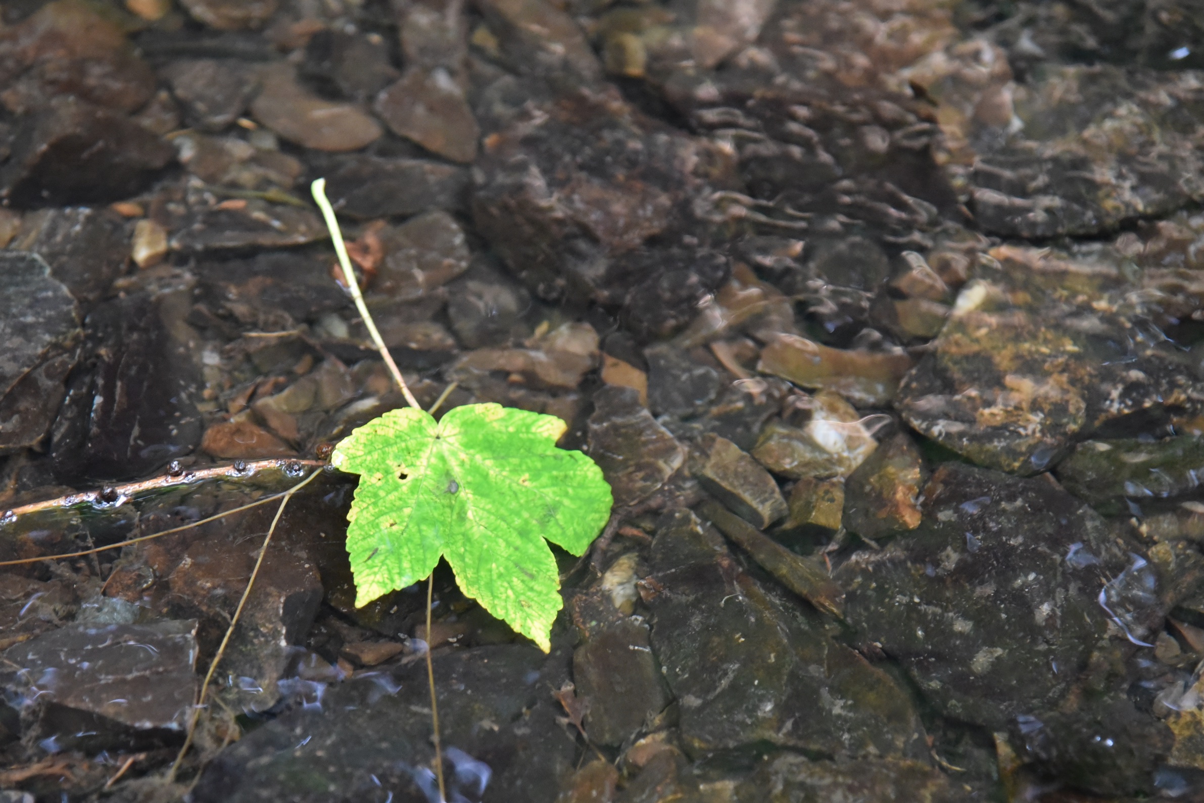
 At the top of the hill Manse Road marks the end of Cregagh townland. I’m marking the end of this post with a sycamore leaf on the rocky riverbed of Cregagh Glen.
more information
Which county is Cregagh in? County Down
Which civil parish is Cregagh in? Knockbreda
Which townlands border Cregagh? To the north, Lisnasharragh. To the east, Castlereagh. To the south, Lisnabreeny. To the west, Ballymaconaghy .
Click here for a map of Cregagh on Townlands.IE.
And finally, click here to read about the townland’s name on my usual source – PLACENAMESNI.ORG.

[…] Here is an INDEX of all the townlands covered so far. Click on the name to go straight to my page about that townland. Or skip straight to this month’s new posts: Carsonstown Cregagh […]
LikeLike
[…] east, Ballykeel, Crossnacreevy and Slatady. To the south, Clontonakelly. To the west, Knockbreckan, Cregagh and […]
LikeLike
[…] the north, Carnamuck. To the east, Braniel and Slatady. To the south, Lisnabreeny. To the west, Cregagh and […]
LikeLike
Beautiful photos Karolyn. Such a pretty place.
LikeLike
Thank you. We’re lucky to have places like this so close to the city.
LikeLike
[…] Ballymaconaghy occupies the land between the Glencregagh Road (steep and twisty, but suitable for cars) and the Cregagh Glen (steep and twisty and suitable only for bloggers in hiking boots). That’s an exaggeration: Cregagh Glen actually has a well-signposted and popular path through the woods, which I also mentioned in my post from the townland of Cregagh. […]
LikeLike
[…] Which townlands border Lisnasharragh? To the north, Multyhogy. To the east, Carnamuck and Castlereagh. To the west, Ballymaconaghy and Cregagh. […]
LikeLike