
Lisnabreeny townland is in the Castlereagh Hills, to the southeast of Belfast. Those hills aren’t massive, but Lisnabreeny stands at the highest point, 170 metres above sea level.
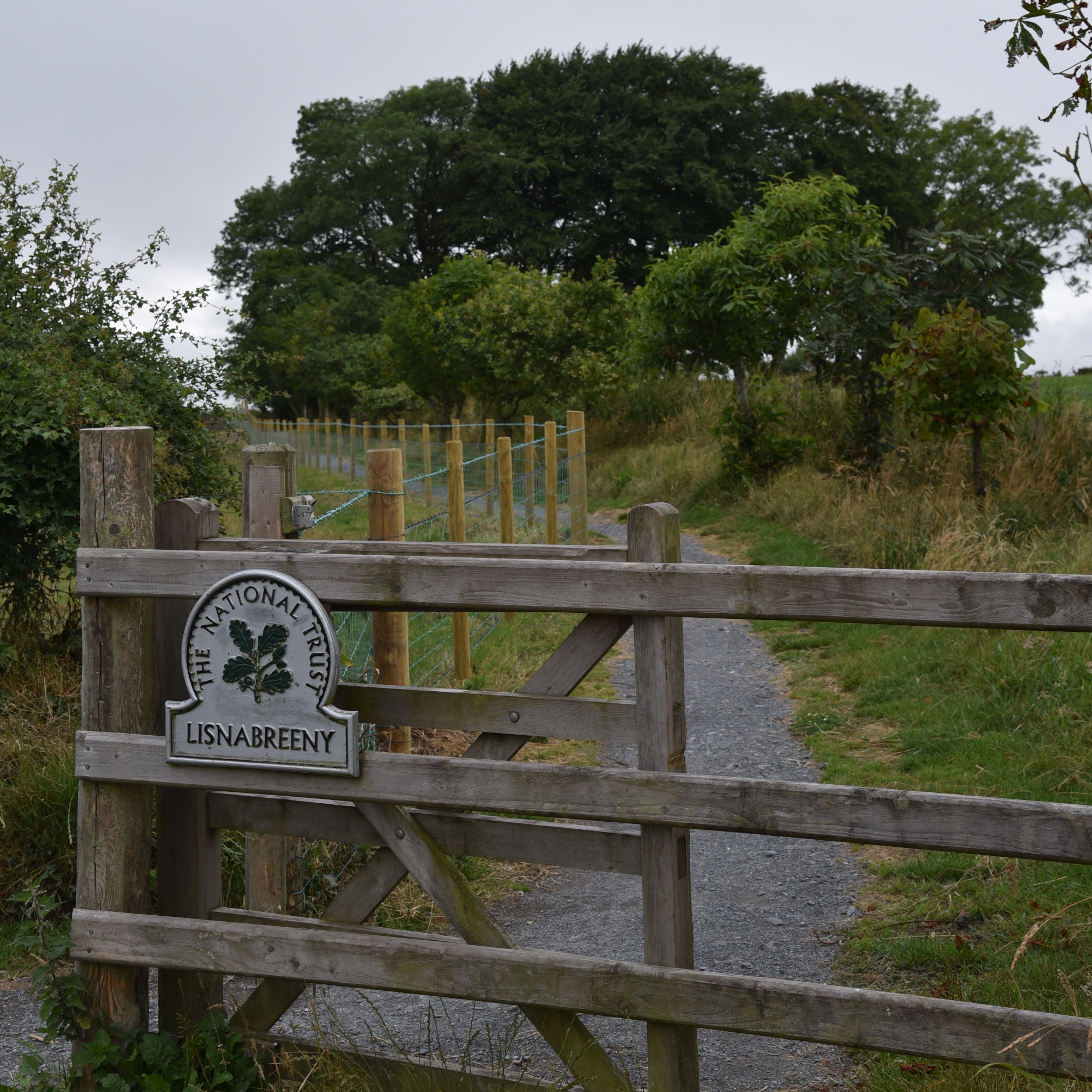 The large trees in that photo are on the edge of an earthen mound known as a ring fort or rath (from the Irish ráth). This rath is probably the one from which the townland took the Irish name Lios na Bruíne meaning ‘fort of the hostel or fairy dwelling’, giving the English version Lisnabreeny.
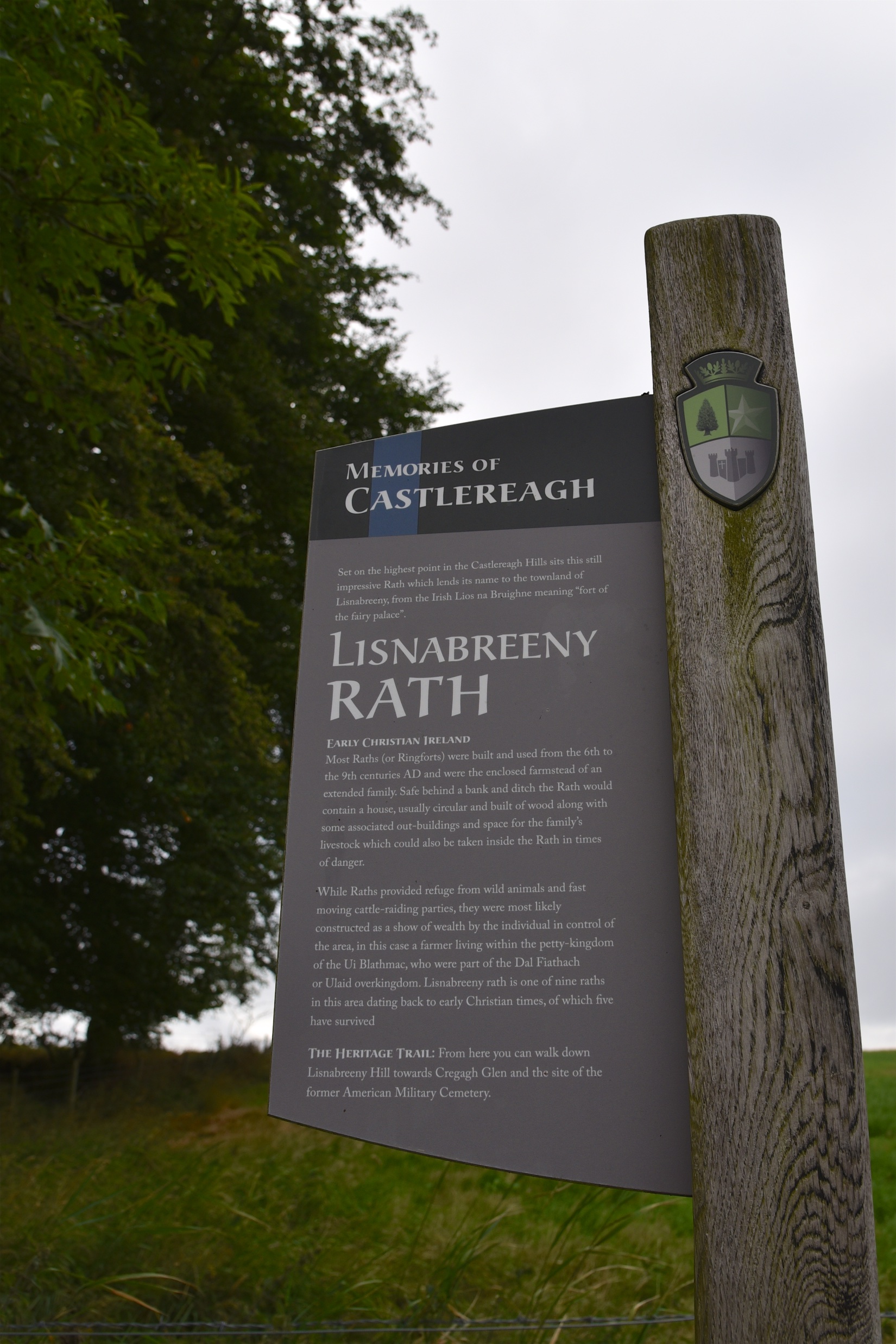 The Ulster Archaeological Survey surveyed the rath in 2007. Their report is silent on the presence of fairies, but ends with this question:
“Situated as it is on hills overlooking Belfast, Lagan Valley and approaches from Strangford it may have been in a position to witness the arrival of the Vikings towards the end of the first millennium and possibly the advance of John De Courcy towards Carrickfergus on the north shore of Belfast Lough at the beginning of the second millennium, it therefore begs the question did either of these two parties become aware of this place?”
On the day of my visit, the rath witnessed the arrival of a Cunard cruise ship and a Stena Line ferry.
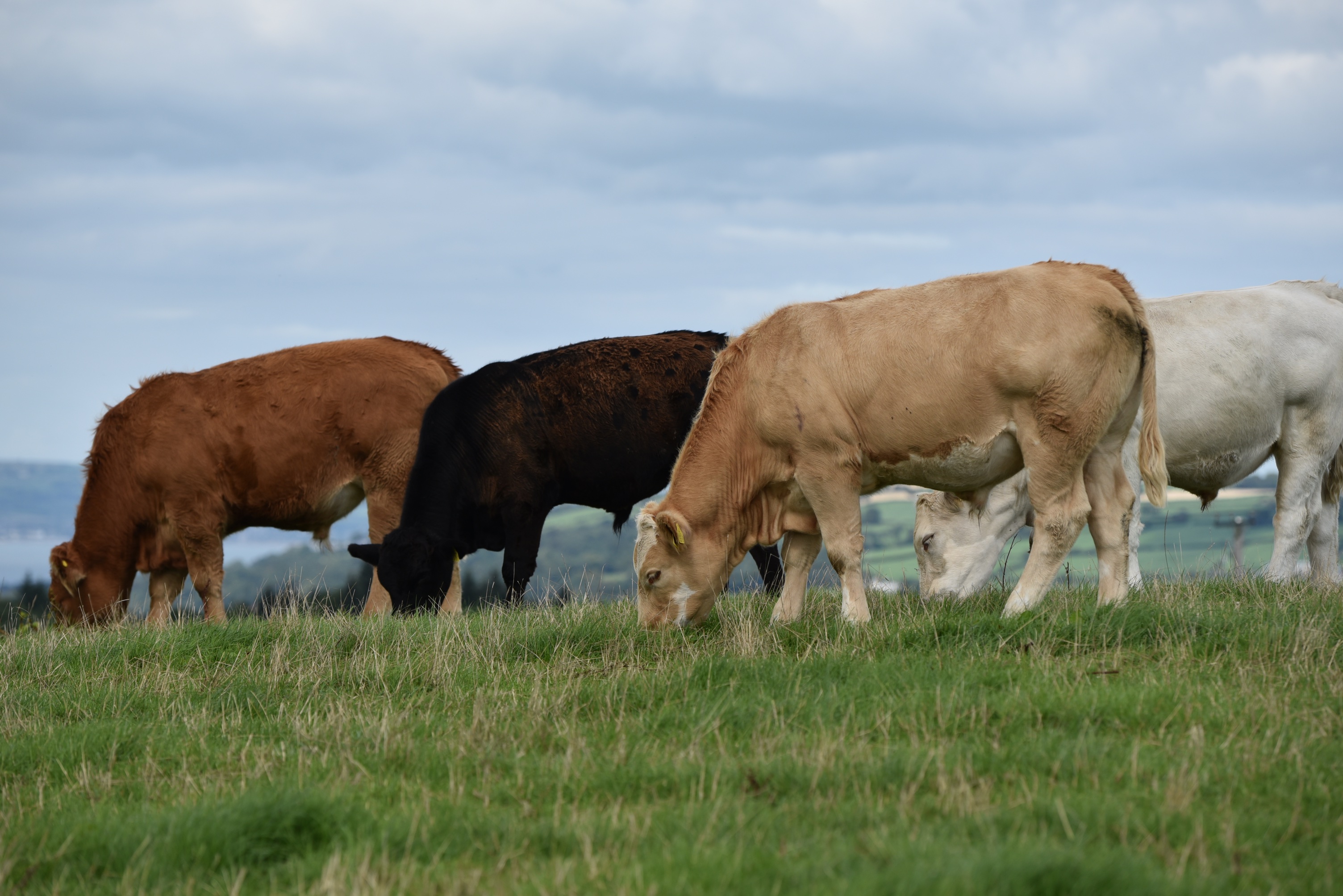
 Who would see any approaching invaders today? Mainly cattle, though they seem unlikely to lift their heads to look north to the lough…
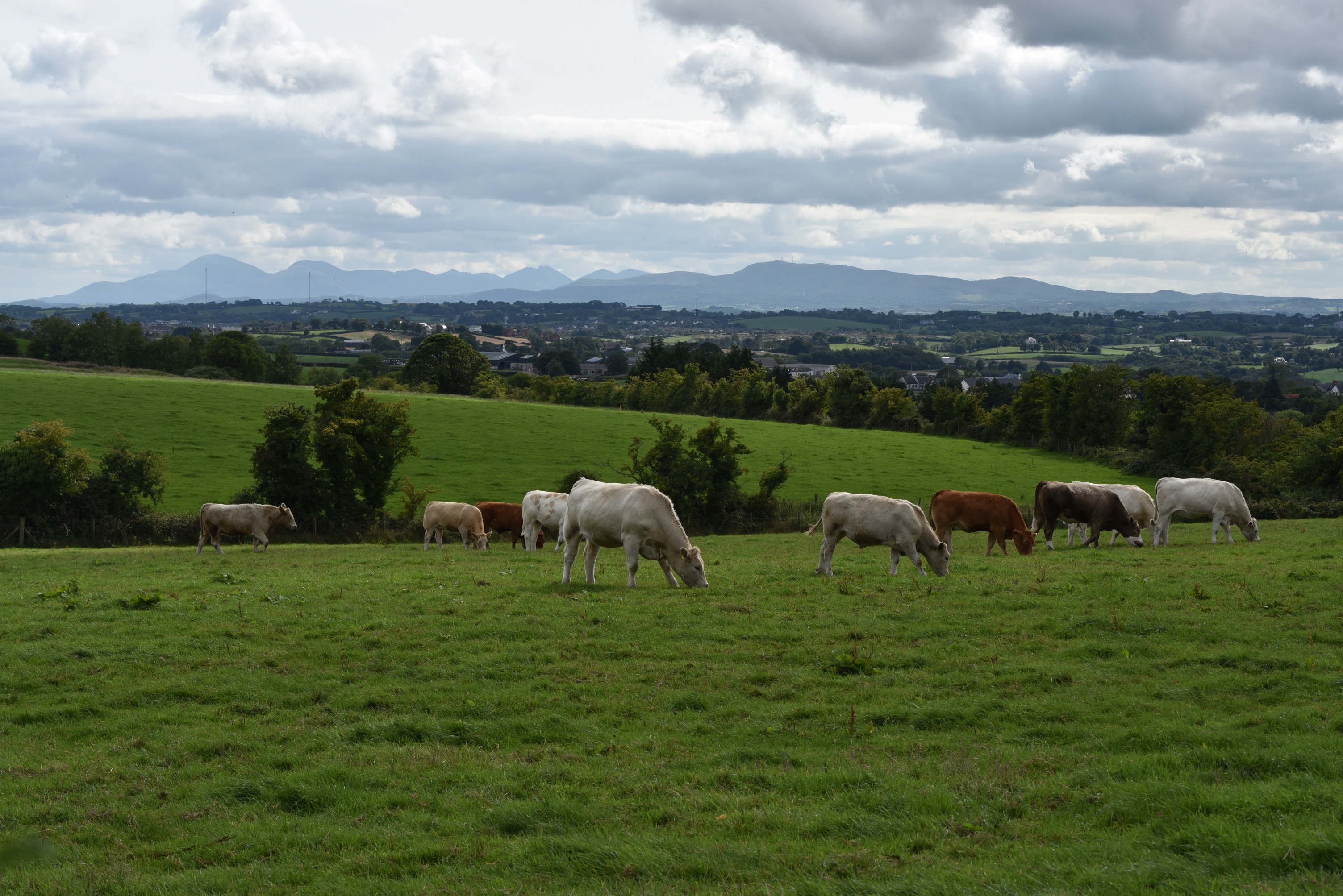
 ….or south to the Mournes.
 The cattle have their own water supply.
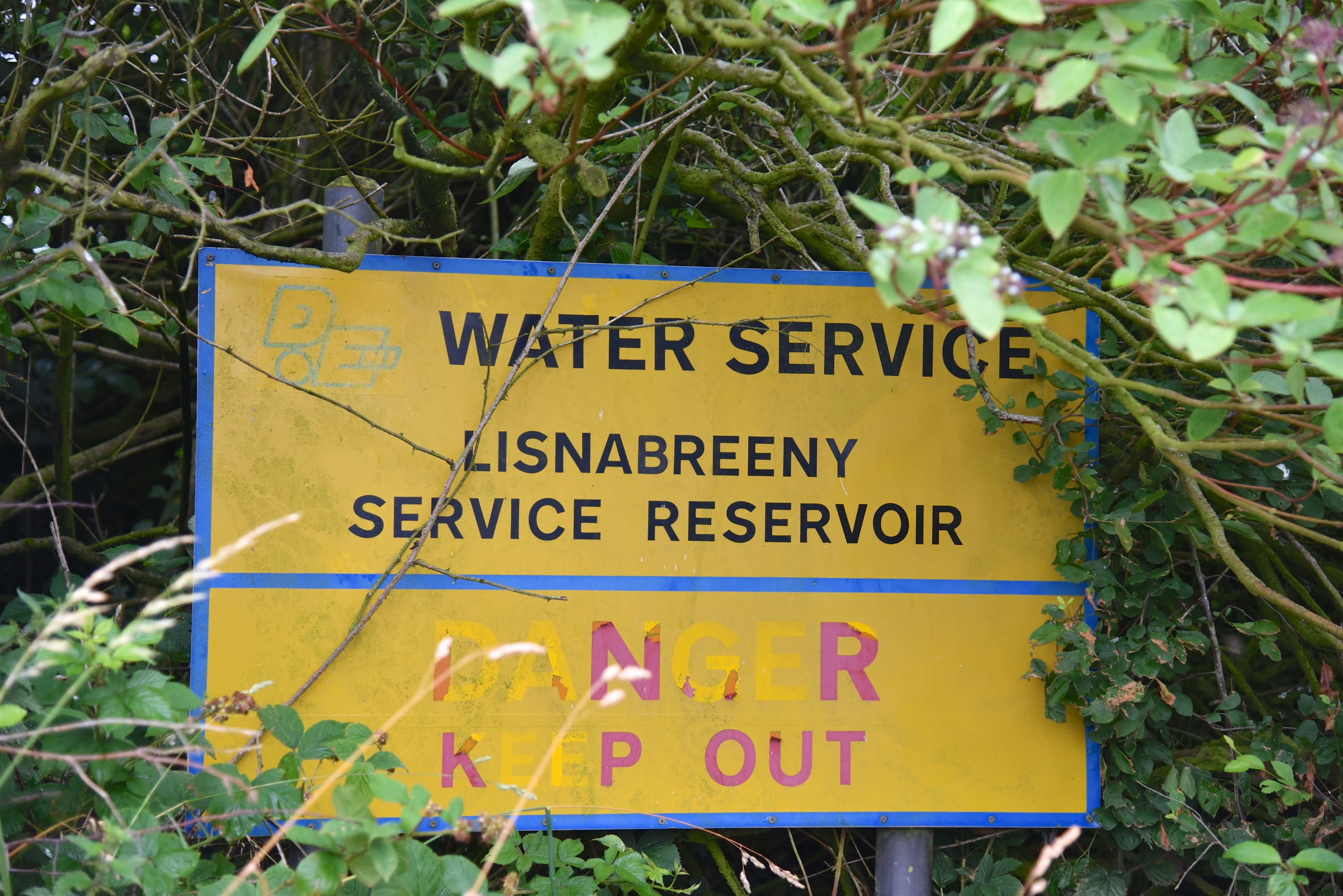
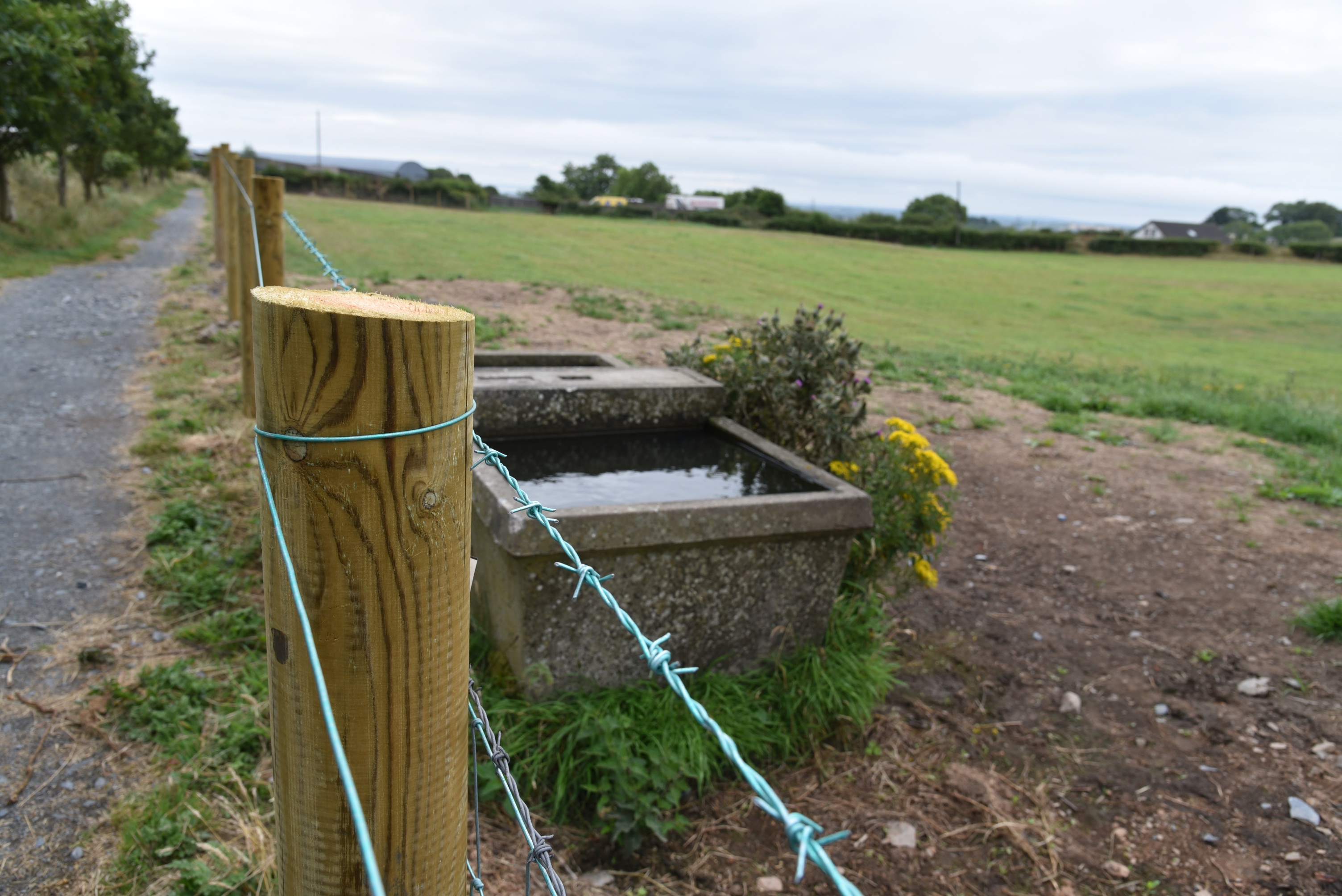 On a larger scale, Lisnabreeny Service Reservoir collects water for humans.
 Much of the milk that I buy comes from Farmview Dairies on the Lisnabreeny Road.
 In 1991 Lisnabreeny House became the site of Belfast’s first religiously integrated school – Lagan College.
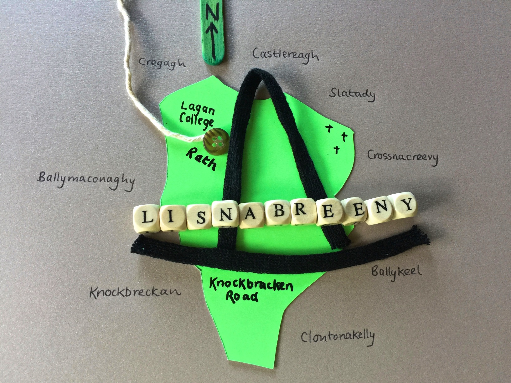
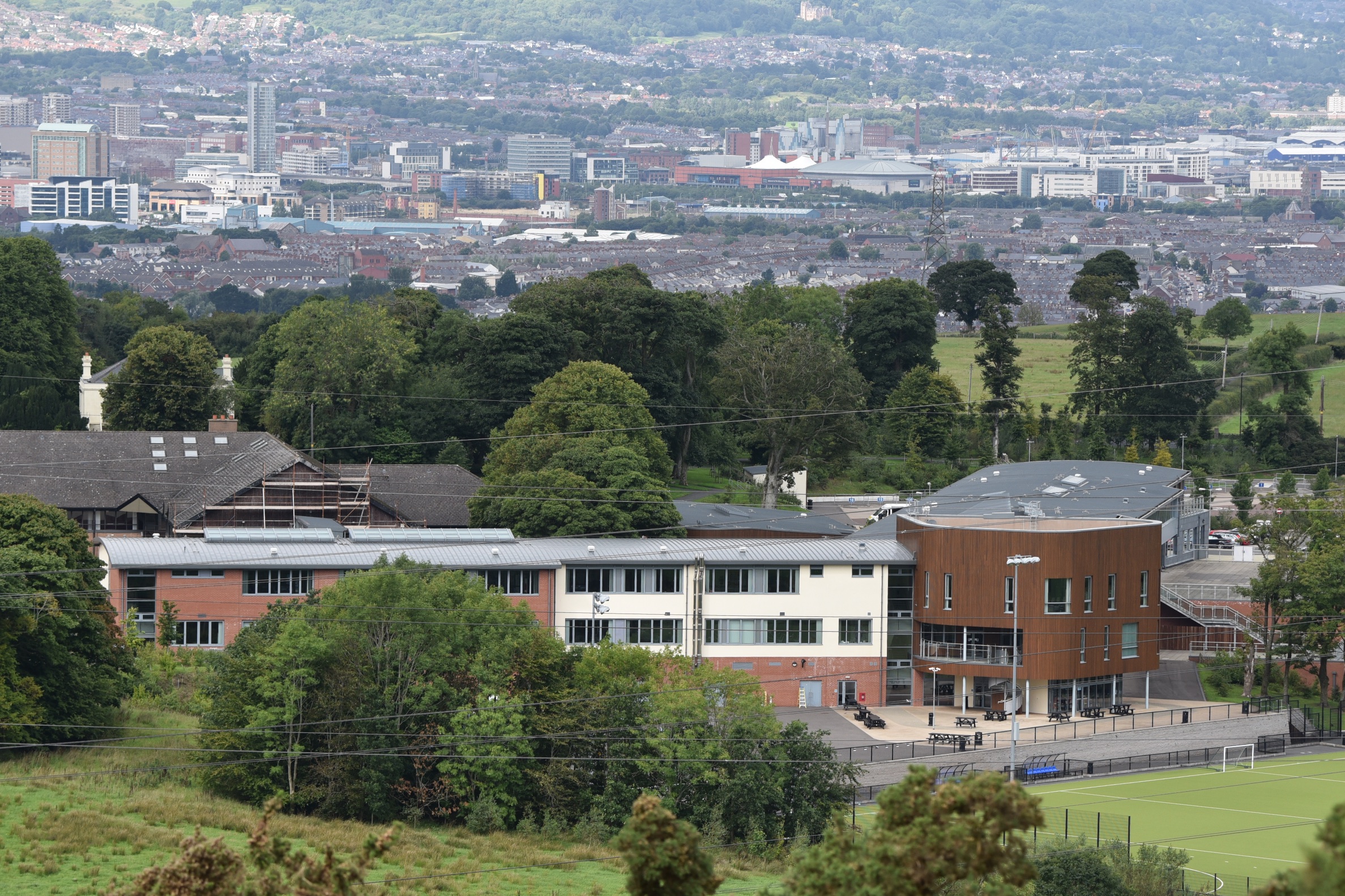 Before it was a school, Lisnabreeny House had been the home of the writer Nesca Robb (who donated it to the National Trust), then a youth hostel, then a base for the United States Army during the Second World War. The school is marked on my sketch map of the townland. Lisnabreeny is in green; it is ringed by the names of neighbouring townlands.
more information
Which county is Lisnabreeny in? County Down
Which civil parish is Lisnabreeny in? Knockbreda
Which townlands border Lisnabreeny? To the north, Castlereagh. To the east, Ballykeel, Crossnacreevy and Slatady. To the south, Clontonakelly. To the west, Knockbreckan, Cregagh and Ballymaconaghy.
Click here to see my photographs of gravestones connected to Lisnabreeny.
Click here for a map of Lisnabreeny on Townlands.IE.
And finally, click here to read about the townland’s name on my usual source – PLACENAMESNI.ORG.

[…] Here is an INDEX of all the townlands covered so far. Click on the name to go straight to my page about that townland. Or skip straight to this month’s new posts: Lisnabreeny […]
LikeLike
[…] townlands border Cregagh? To the north, Lisnasharragh. To the east, Castlereagh. To the south, Lisnabreeny. To the west, […]
LikeLike
[…] border Castlereagh? To the north, Carnamuck. To the east, Braniel and Slatady. To the south, Lisnabreeny. To the west, Cregagh and […]
LikeLike
[…] Higher up in the hills, the streets of Ballymaconaghy eventually give way to fields. The houses in the next photo, and the field beside them, are in Ballymaconaghy. The cattle are in the townland of Lisnabreeny. […]
LikeLike
[…] Which townlands border Slatady? To the northwest, Castlereagh. To the northeast, Braniel. To the south, Crossnacreevy and Lisnabreeny. […]
LikeLike
[…] To the east, Lisleen and Moneyreagh. To the south, Monlough and Clontakelly. To the west, Lisnabreeny […]
LikeLike
[…] ring of townlands that have already appeared in this blog: Ballykeel, Braniel, Gilnahirk, Lisleen, Lisnabreeny and Slatady. I don’t know how or why I’ve avoided Crossnacreevy for so long. It’s […]
LikeLike
[…] year, I took this photo of Stormont from a hill in Lisnabreeny, without knowing that it would prove useful today. The townland of Killeen is the land of trees and […]
LikeLike