
It’s Day 5 of my summer tour of the County Down coast, and today I’m in the townland of Ratallagh. Ratallagh is on the eastern side of the Ards Peninsula, just south of Portavogie.
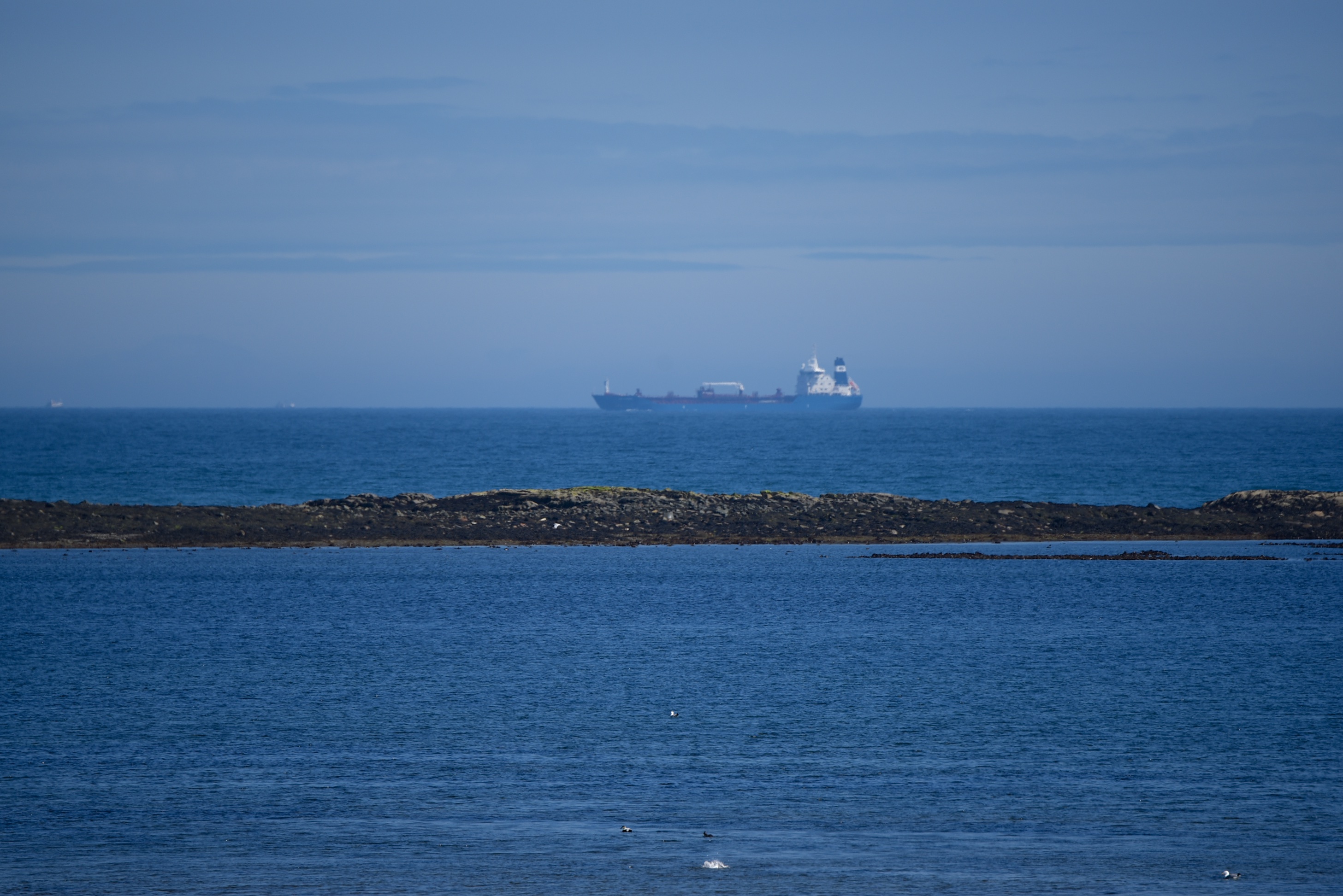
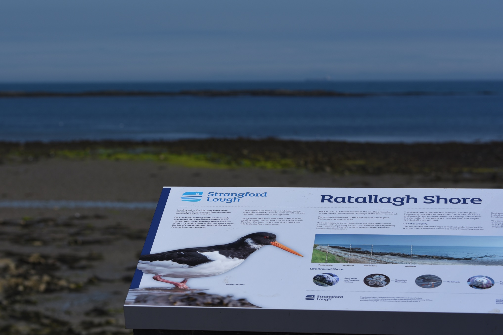 I stopped to read that information panel in a carpark on the A2 Cloughey Road. Despite the “Strangford Lough” logo on the sign, the water in the photo is definitely the Irish Sea, not the lough. Does this image of a ship on the horizon convince you?
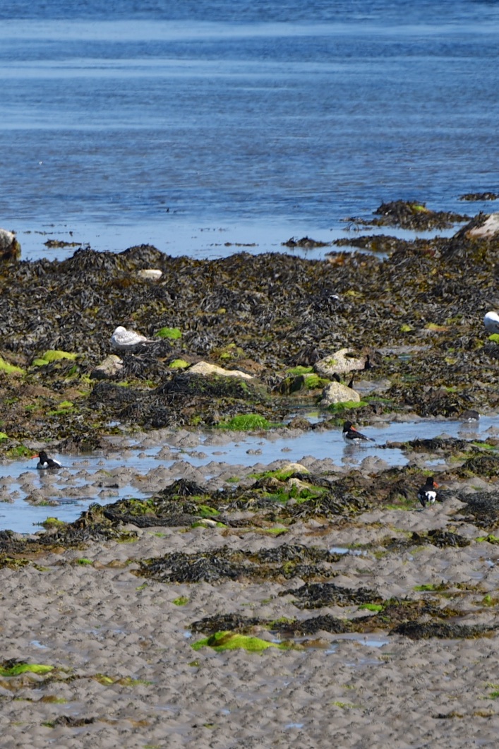
 The sign is more accurate about birds, and its image of an oystercatcher is better than mine.
 People used to walk along fishermen’s paths from Ratallagh to work in the harbour at Portavogie. Click here to read more in a leaflet produced for the Portavogie Heritage Trail.
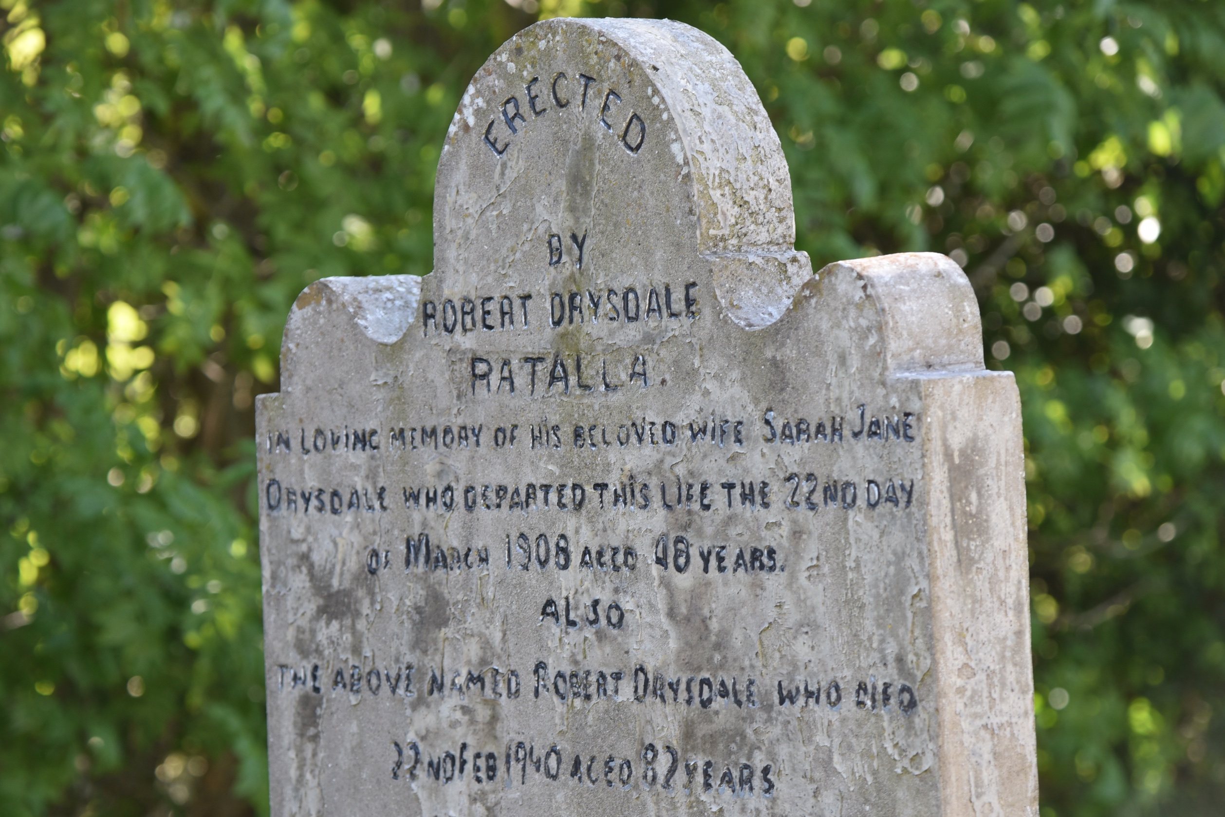
 According to the PLACENAMESNI website, the origin of the name Ratallagh may be the Irish Ráth tSaileach meaning “fort of the willows”. Sometimes it is spelled “Ratalla”, as I saw on several gravestones in the churchyard at Cloughey, and on this one for the Drysdale family in the churchyard at Ardkeen.
 As I was exploring the townland, look who was watching me from the field on the other side of the road.
 The horse won’t be the fastest thing in the townland. Ratallagh extends inland along the Bog Road as far as the Kirkistown Motor Racing Circuit. Kirkistown was once an airfield, but since 1953 it has been home to the 500 Motor Racing Club of Ireland.

more information
Click here for the website of the Kirkistown motor racing circuit.
Which county is Ratallagh in? County Down
Which parish is Ratallagh in? Ardkeen
Which townlands border Ratallagh? To the north, Ballycran More and Portavogie. To the south and west, Kirkistown. To the east, the Irish Sea.
Click here to see a map of Ratallagh on the website of Townlands.IE.
And finally, click here to read more about the townland name on PLACENAMESNI.ORG.

[…] skip straight to this month’s new posts: Ratallagh, Kearney, Keentagh, Tara, Cloghy, Rosemount, Ballyleidy, Ballymartin, […]
LikeLike