
Ballyvarnet is on the edge of the town of Bangor. In 2019 the townland name is being used for these new houses.

The southern half of the townland lies inside the Clandeboye Estate, home of the Marchioness of Dufferin and Ava. But that doesn’t mean that it’s off-limits. I was able to follow this path, the “Clandeboye Way”, to explore the townland in July 2015.
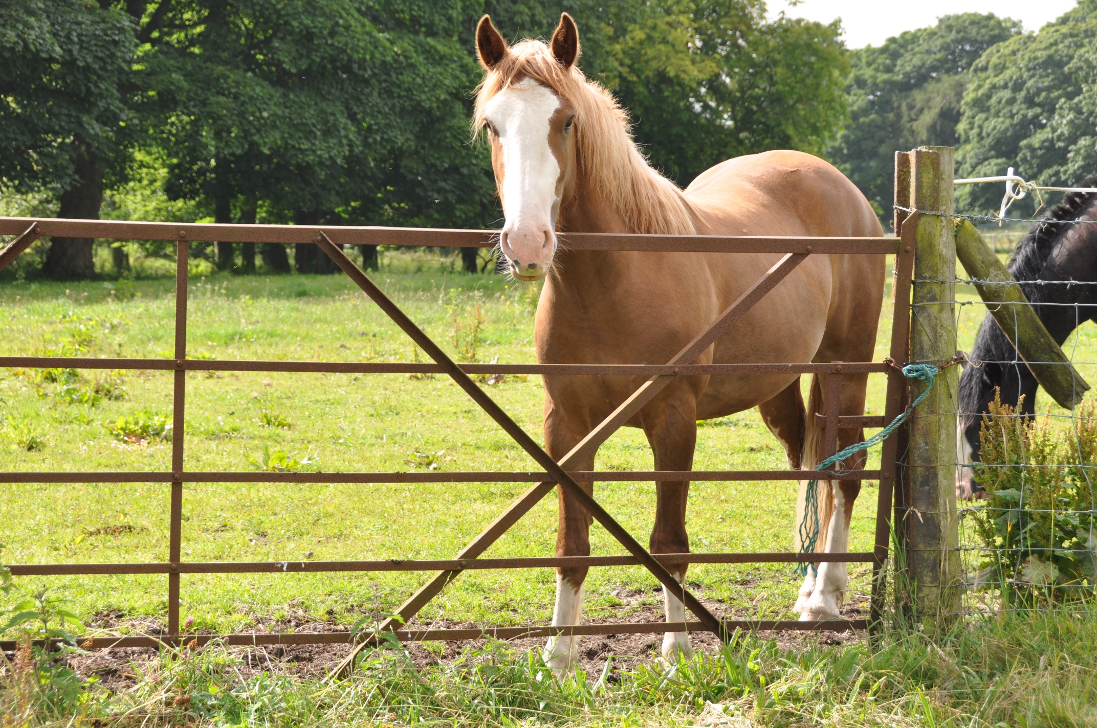
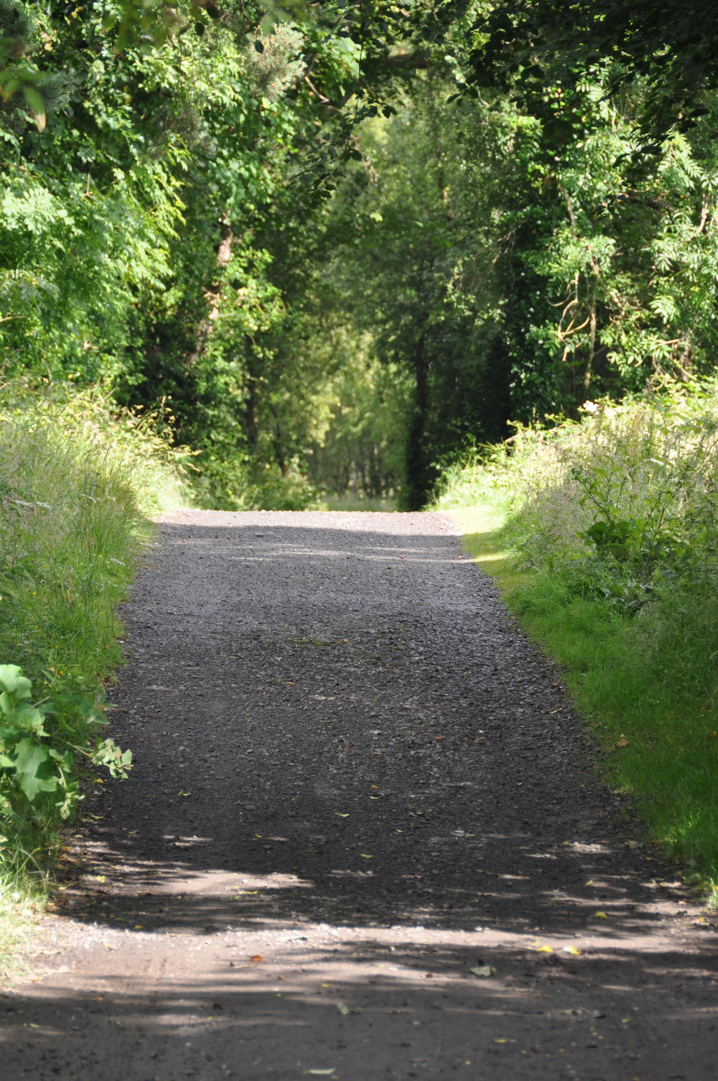 I walked from the entrance on the Crawfordsburn Road. The horses on one side of the path found me interesting.
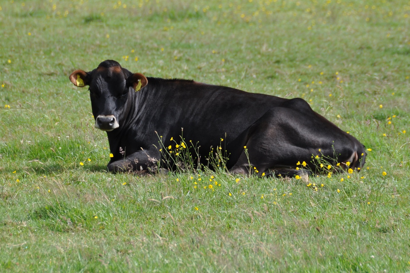
 The cattle on the other side showed no interest at all.
 This lake is the boundary between Ballyvarnet and Conlig townlands. Photos from the rest of my walk appear in my post from Conlig.
 But that’s not the end of Ballyvarnet. The townland extends north of the Clandeboye Estate, in a narrow strip all the way to the shore of Belfast Lough. This northern part includes Strickland’s Glen, which I visited in February 2016.
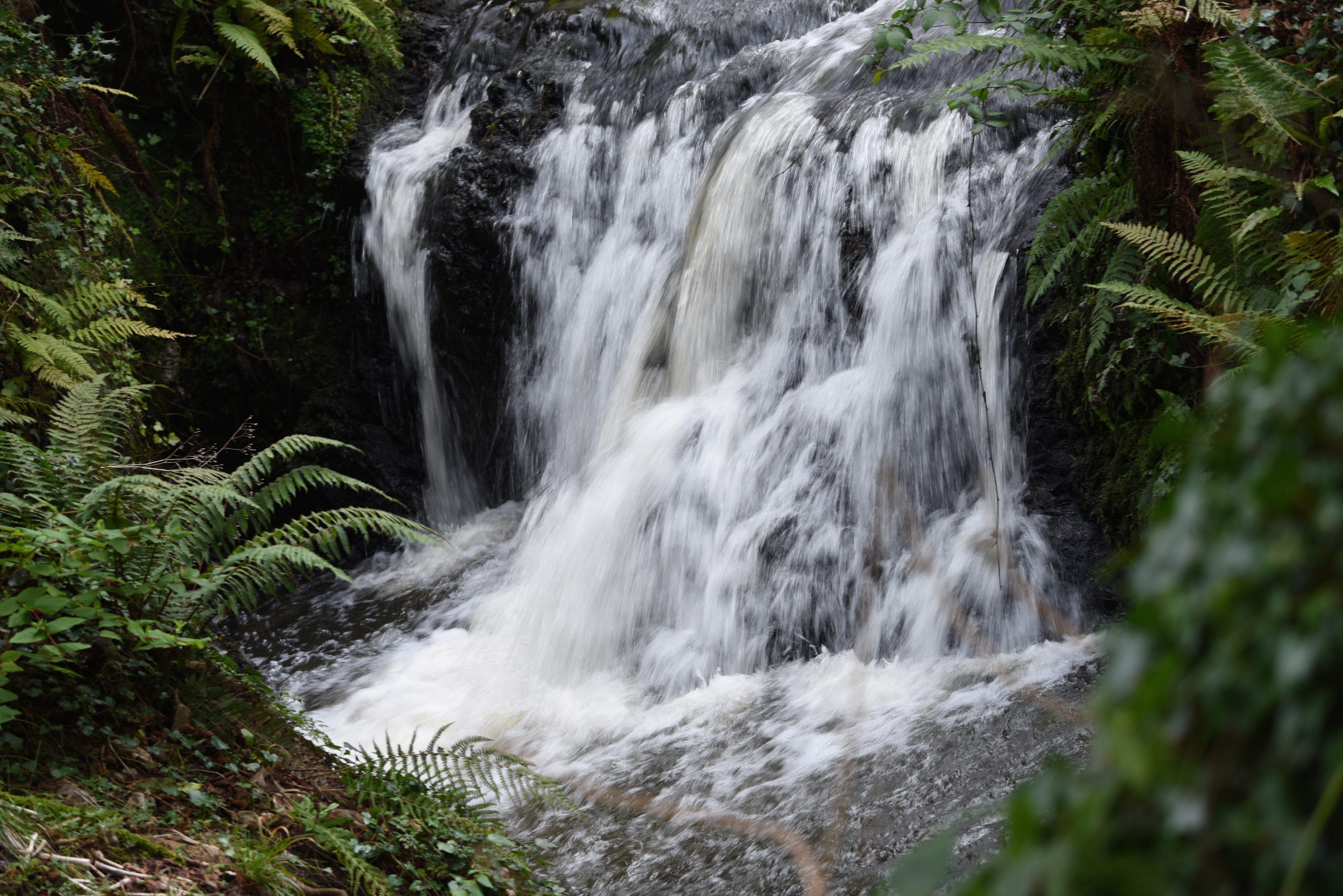
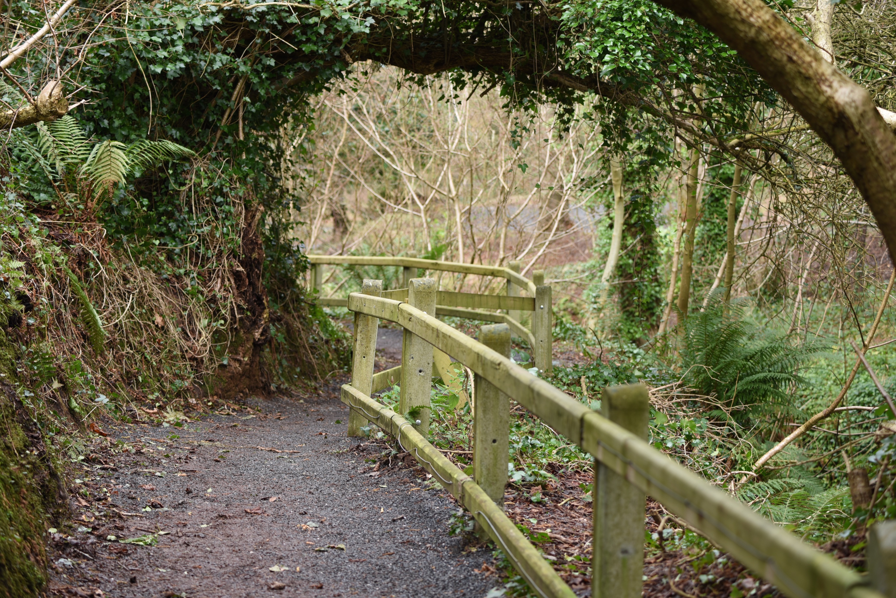 The Bryan’s Burn flows through Strickland’s Glen, separating Ballyvarnet from the townland of Corporation (which covers most of Bangor). The stream is criss-crossed by a series of paths and bridges leading down to the sea.
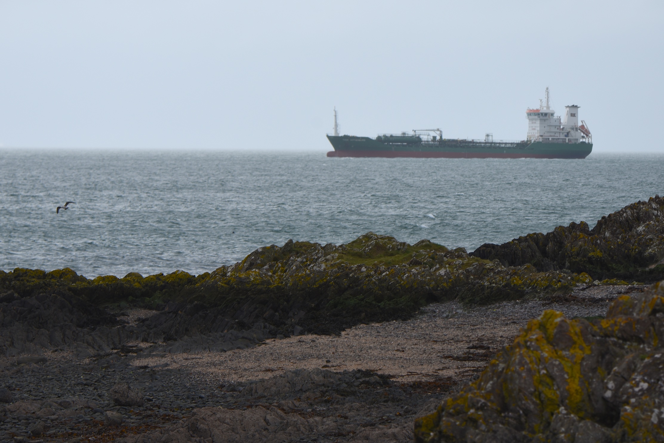
 When you reach the shore at Smelt Mill Bay, you can turn left towards Belfast or right towards Bangor, and walk along the North Down Coastal Path, which is part of the Ulster Way.
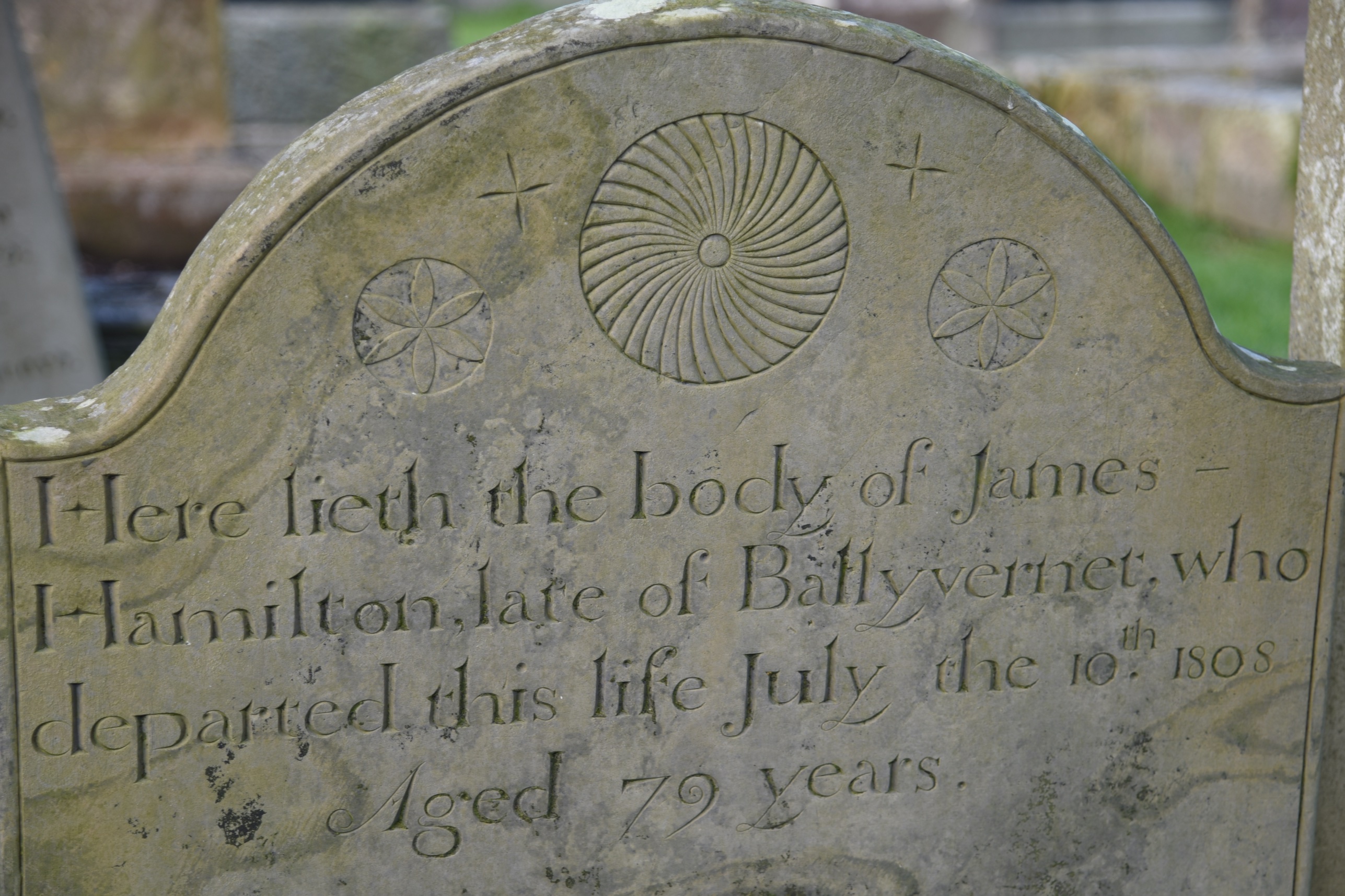
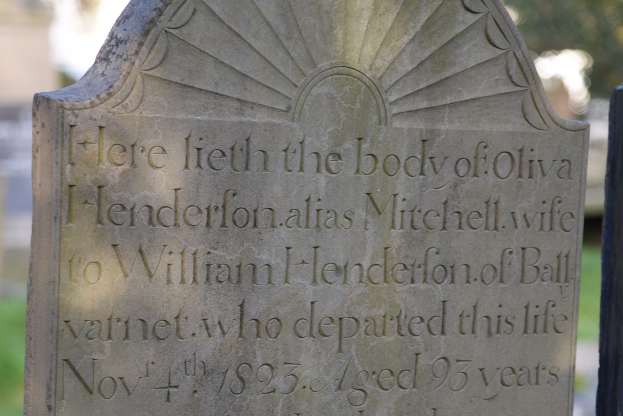
 According to the PLACENAMESNI website, the name Ballyvarnet derives from the Irish Baile Bhearnan meaning “townland of the gap”. The spelling of the townland name has changed over the years, so as well as “varnet”, I have seen “vernon”, “vernet”, and “varnen”. Here are two different versions from gravestones in Bangor.
more information
Click on these links for information on the walking routes in Ballyvarnet:
Which county is Ballyvarnet in? County Down
Which civil parish is Ballyvarnet in? Bangor
Which townlands border Ballyvarnet? To the north, Belfast Lough. To the east, moving south, Corporation, Rathgael, Lisbane, Conlig and Whitespots. To the southwest, Ballyskeagh. To the west, moving north, Ballyleidy, Bangor Bog and Carnalea.
Click here for a map of Ballyvarnet on Townlands.IE.
Click here for information on the PLACENAMESNI website about the history of the name Ballyvarnet.

[…] skip straight to this month’s new posts: Ballyvarnet, Divis and Black Mountain, […]
LikeLike
[…] Corporation North (and a tiny bit of Corporation South) , Tullynagardy, Ballyskeagh Low, Ballyvarnet, and […]
LikeLike
[…] townland is Conlig, near Bangor. Do you remember the lake from my post from Ballyvarnet townland? After the lake, I walked on along the Clandeboye Way, under a sun-dotted canopy of […]
LikeLike
[…] To the east, still within the Clandeboye Estate, the townland of Ballyvarnet. […]
LikeLike
[…] is within the townland of Corporation? On the coastline, Corporation starts at the edge of Ballyvarnet in Smelt Mill Bay, goes round the headland in to Bangor Bay, past the marina, out to the next […]
LikeLike
[…] Which townlands border Carnalea? Ballykillare, Bangor Bog and Ballyvarnet. […]
LikeLike
[…] The Detached Portion borders Ballyleidy, Bangor Bog, Ballymullan and Ballyvarnet. […]
LikeLike
[…] Which townlands border Bangor Bog? Ballykillare, Carnalea, Ballymullan and Ballyvarnet. […]
LikeLike
[…] townlands border Ballyskeagh Low? To the north, Ballyleidy. To the east, Ballyvarnet and Whitespots. To the south, Tullynagardy. To the west, Ballyskeagh […]
LikeLike