
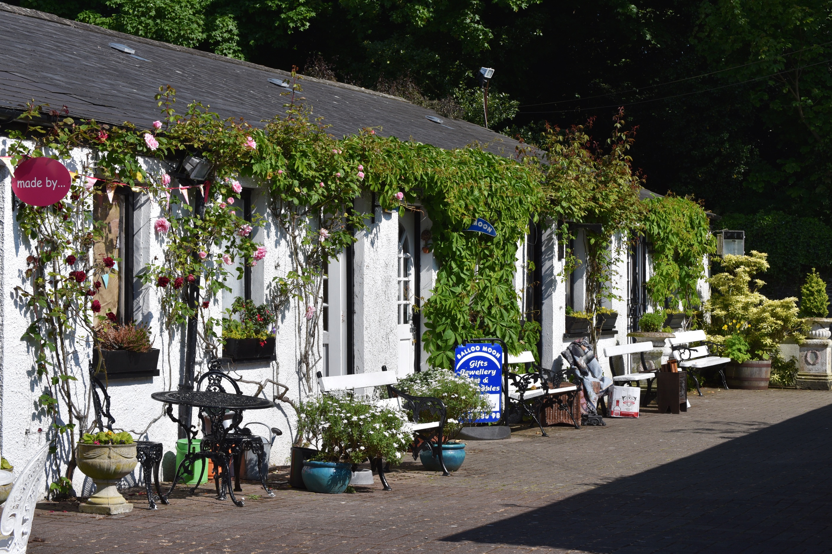
I discovered earlier this month that the abbey in Greyabbey is in the townland of Rosemount. So what does that leave for the townland of Greyabbey? Actually, a whole village, with some pretty antique shops.
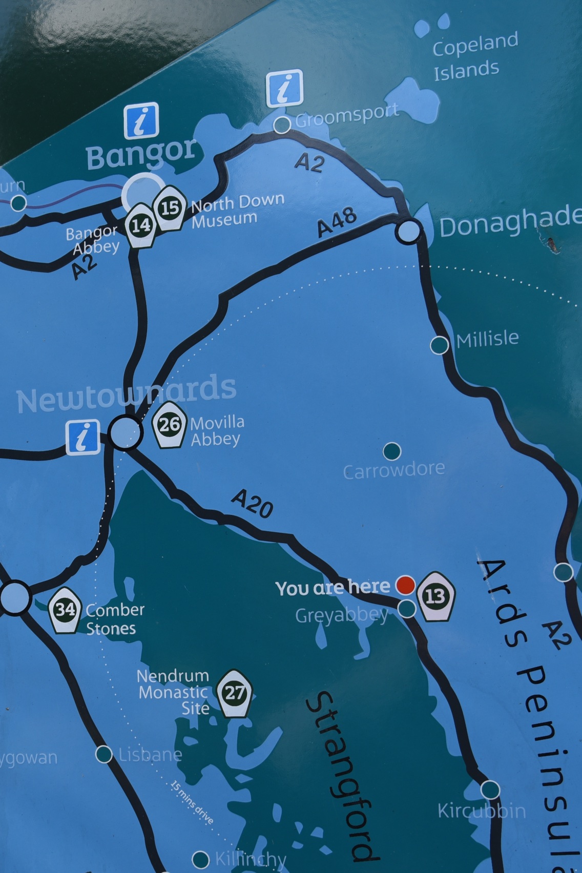
 The village is located on the Ards Peninsula at “you are here” on this map.
 The village name is one word – Greyabbey – but the townland and abbey are both written as two words – Grey Abbey. And there’s a local Ulster-Scots version of the name too: Greba.
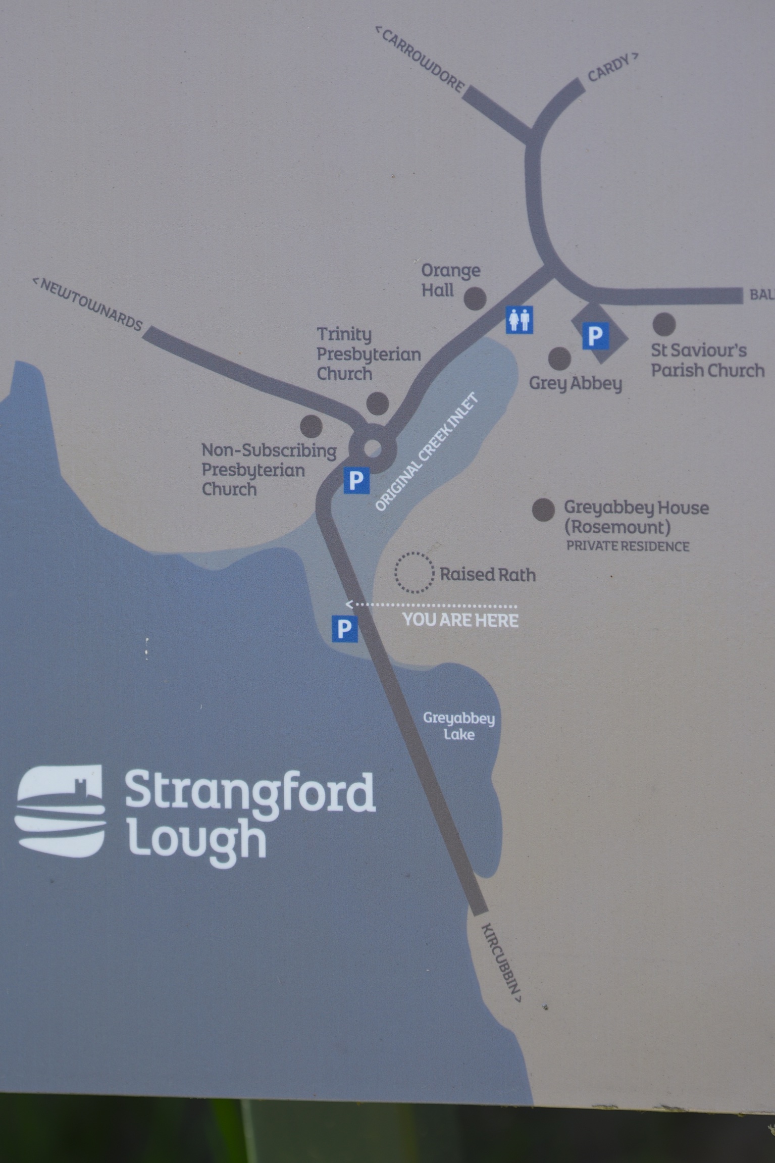
Here’s a more detailed map of the village. The original creek inlet from Strangford Lough has gone, with shops and houses built there.
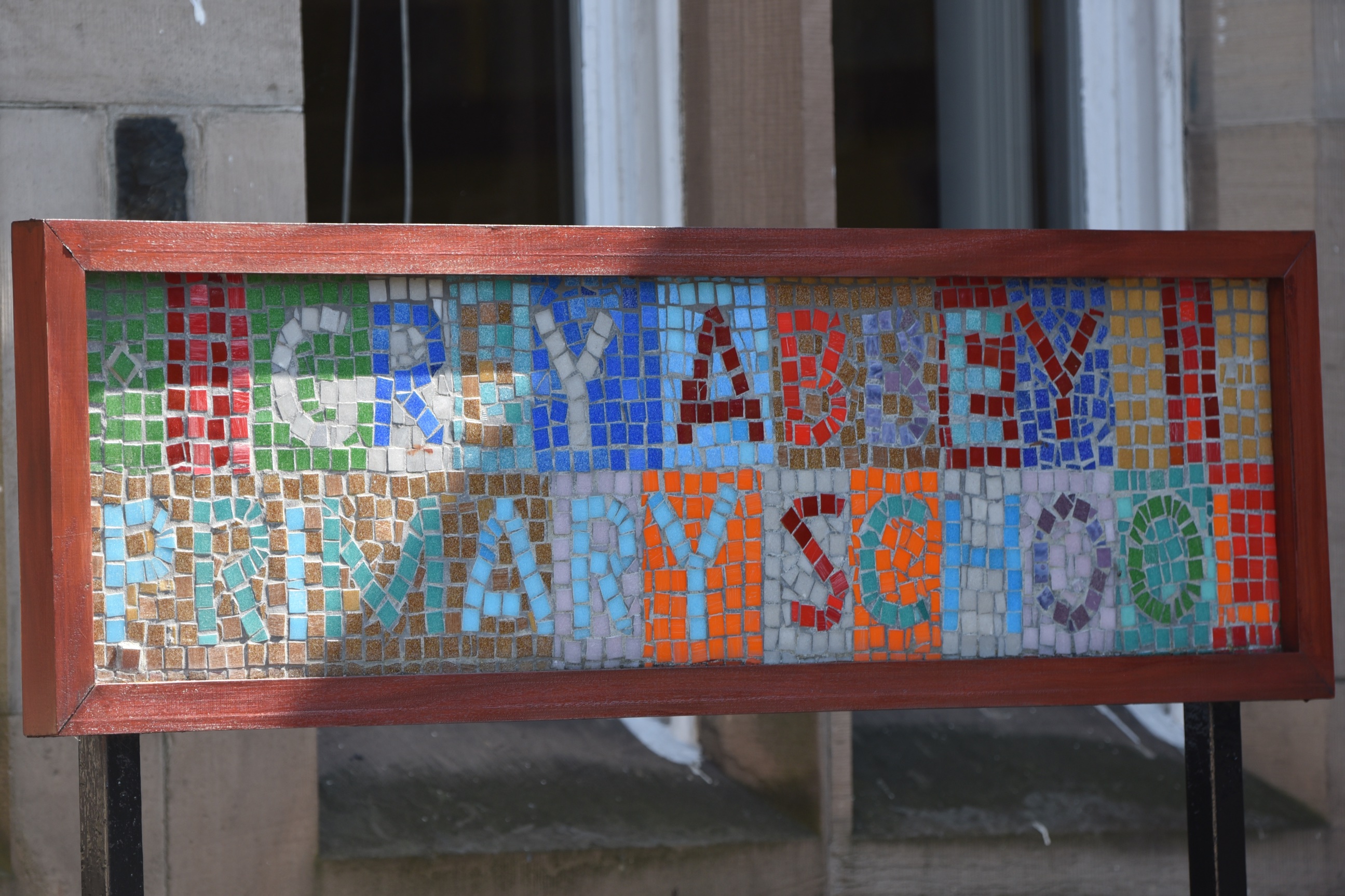
 The local school was built as Grey Abbey Public Elementary School in 1887, the year of Queen Victoria’s Golden Jubilee (as you can see from the stonework above the door).
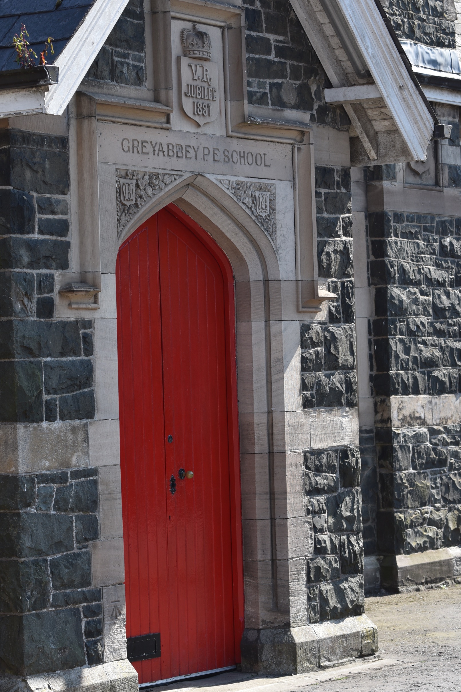 Since 1948 it has been called Grey Abbey Primary School, and it is still going strong.
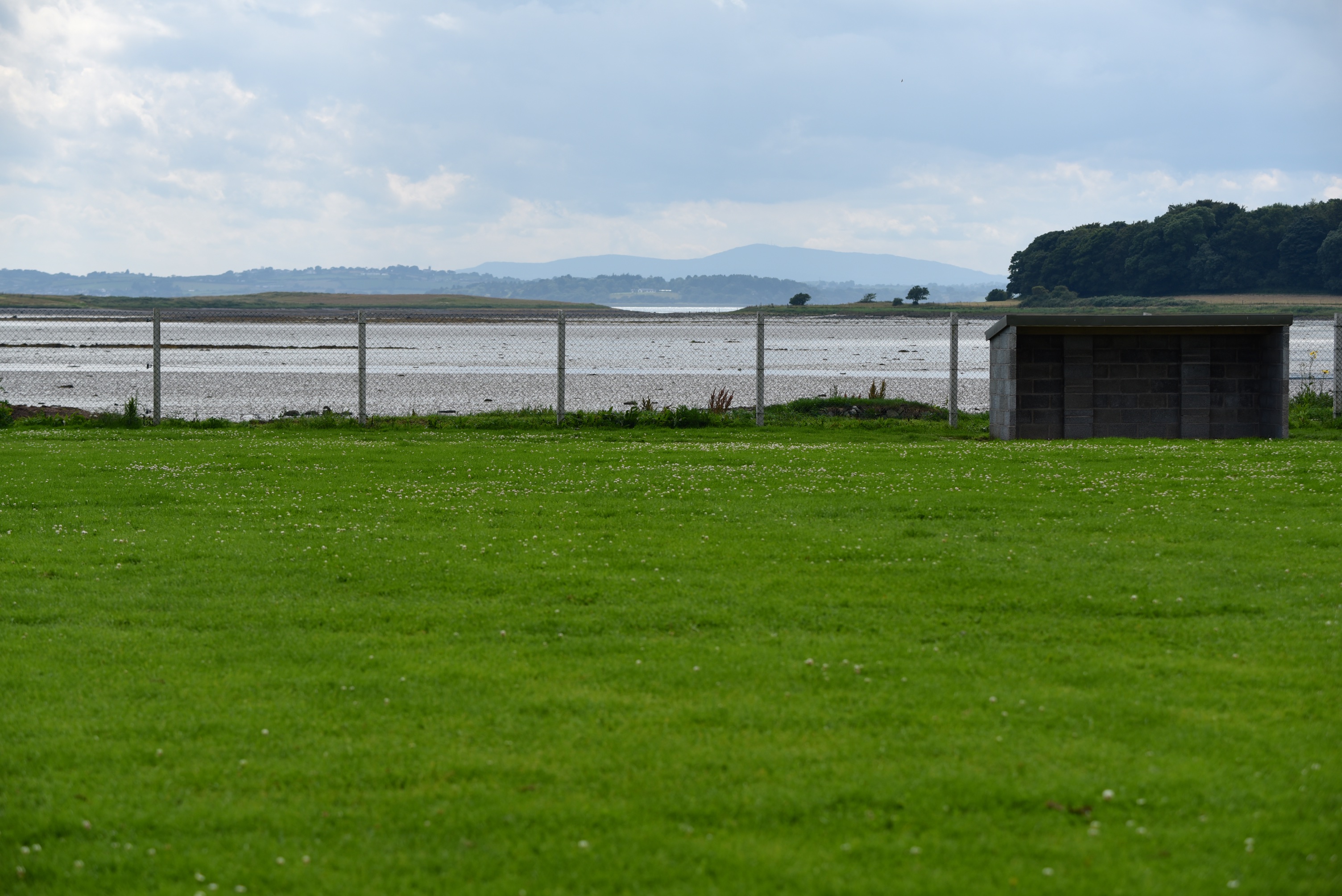
 Greyabbey also has a football pitch. In this interlinked world of townland names, the pitch is home to a team called Rosemount Rec. I wonder if they lose many balls to the waters of the lough at high tide?
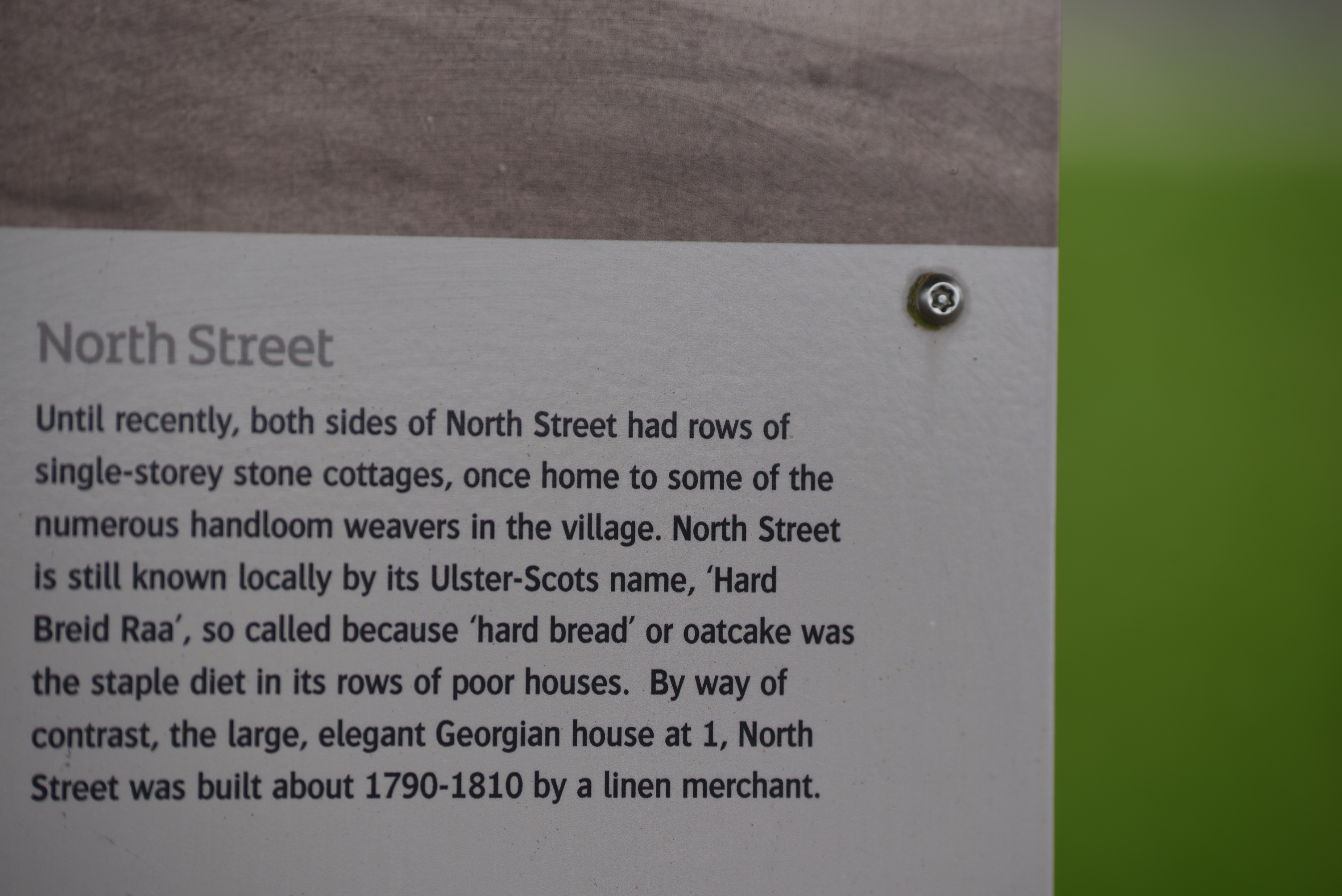
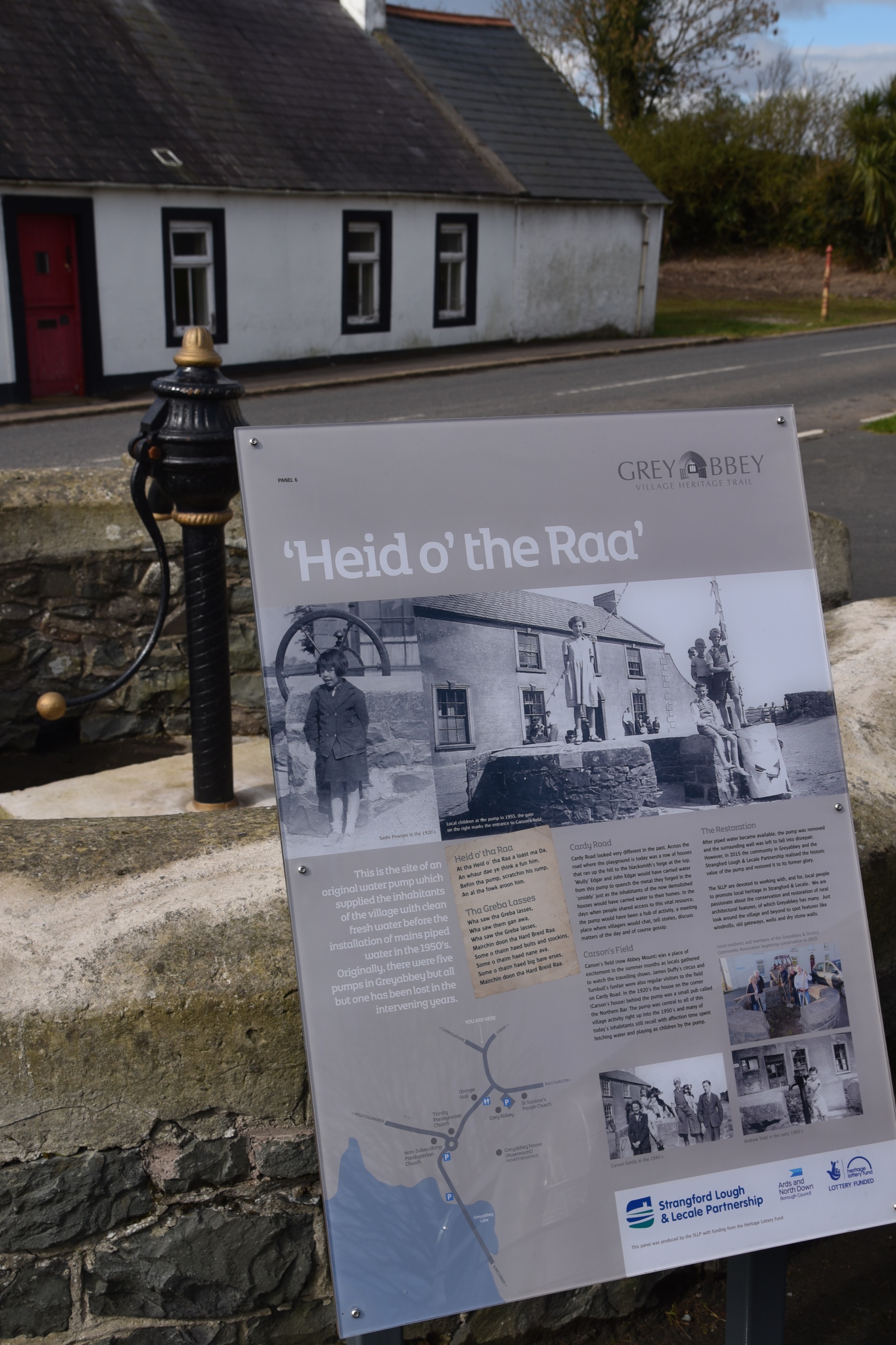
 If you want to learn more about the local history, just start walking through the village and you’re bound to find a sign for the Greyabbey Village Heritage Trail, from the “Tap o’ the Toon” to the pump at the “Heid o’ the Raa”.
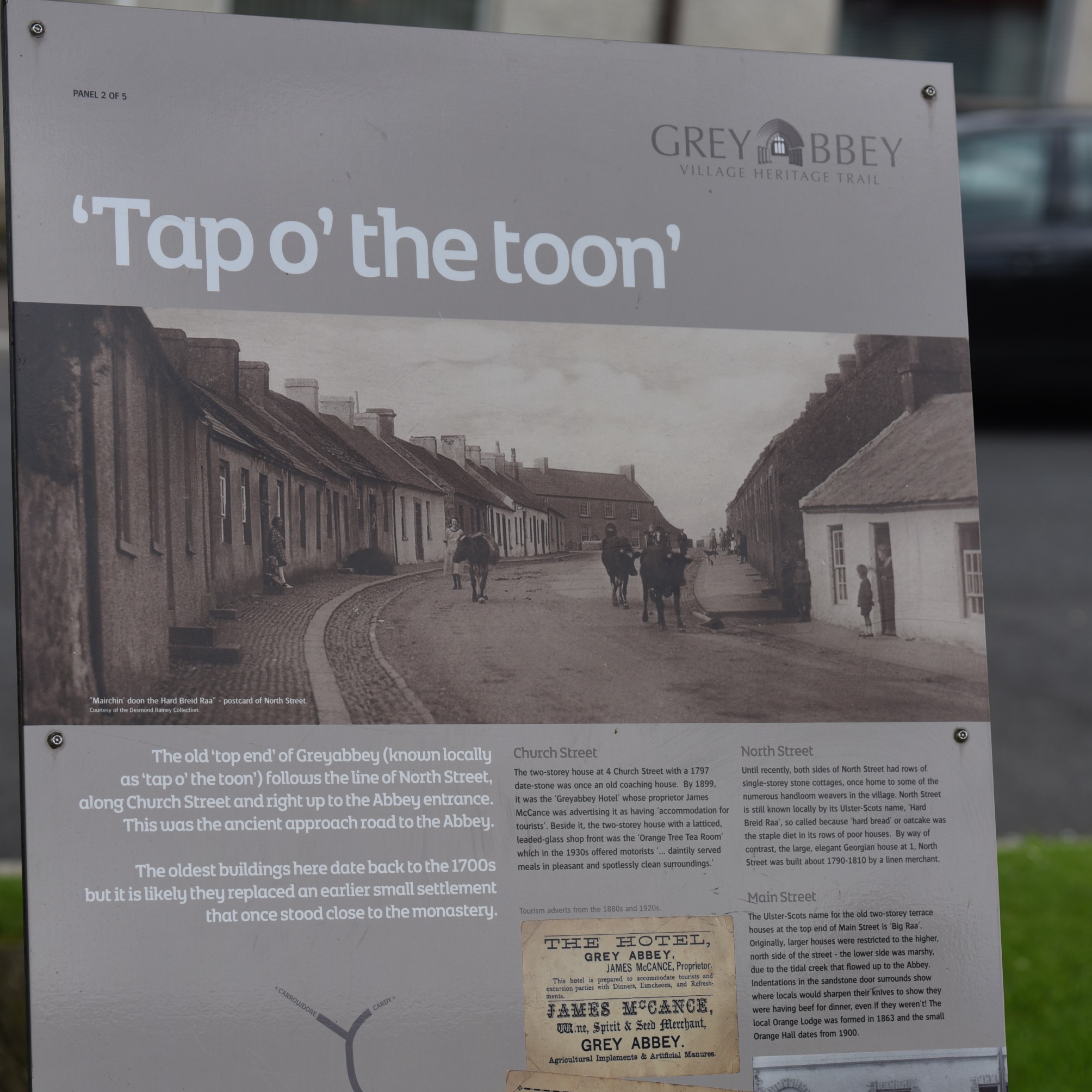 I’ve enlarged part of that sign so you can read about the hard bread road.
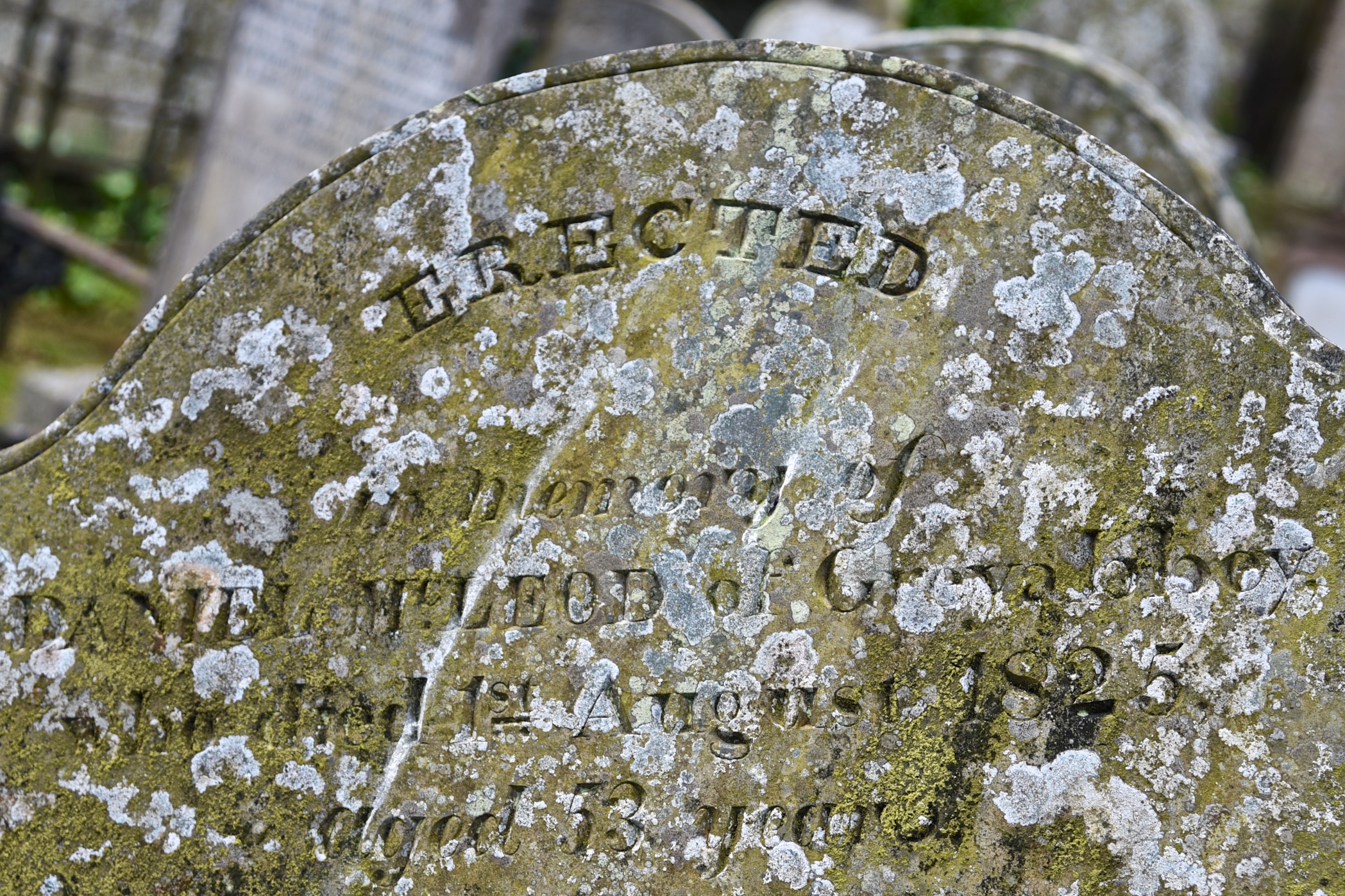
 As well as the signs, the Heritage Trail also offers an Audio Trail, which I installed on my phone. For readers who prefer history written in stone, here is a headstone from 1825 for the McLeod family of Greyabbey.
MORE INFORMATION
Which county is Greyabbey in? County Down
Which civil parish is Greyabbey in? Greyabbey
Which townlands border Greyabbey? To the north, Ballymurphy.
To the east, Ballynester.
To the southeast, Rosemount.
To the northwest, on the inland side of the A20 Road, Gordonall.
To the west, towards the lough, Kilnatierny and Ballyurnanellan.
Click here to see a map of the townland on Townlands.IE.
And finally, click here to read more about the name of the townland on PLACENAMESNI.org.

[…] Rosemount is right beside the village of Greyabbey, beginning behind the shops on the south-eastern side of Main Street. It includes the abbey itself (which surprised me, because I assumed the abbey would be in the townland of Grey Abbey). […]
LikeLike
[…] skip straight to this month’s new posts: Roddans, Grey Abbey, Knockinelder, Ratallagh, Kearney, Keentagh, Tara, Cloghy, Rosemount, Ballyleidy, […]
LikeLike