
Today’s townland is a new one – Sydenham Intake. It lies between Belfast Lough and the Sydenham district of East Belfast, on land reclaimed from the lough.
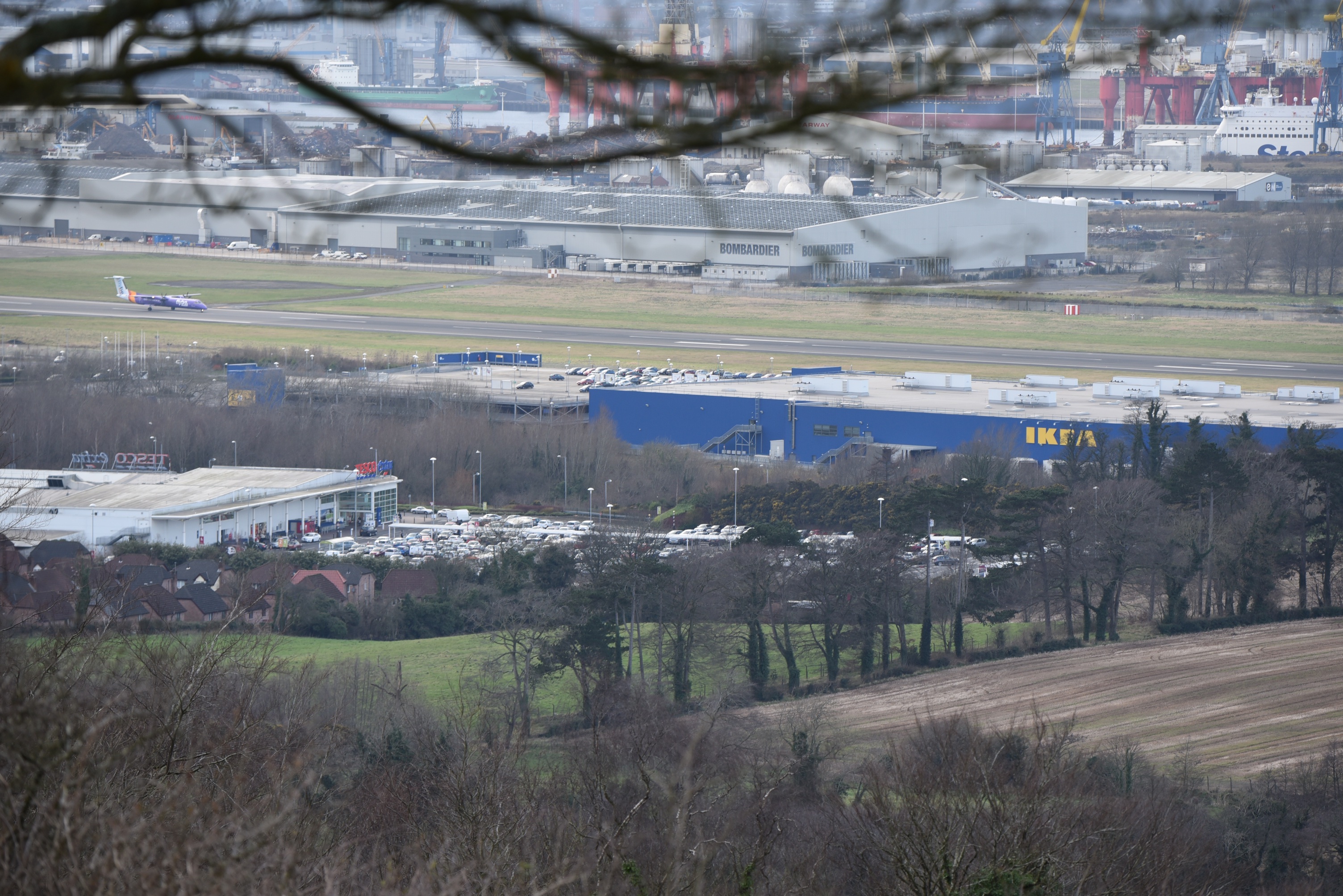
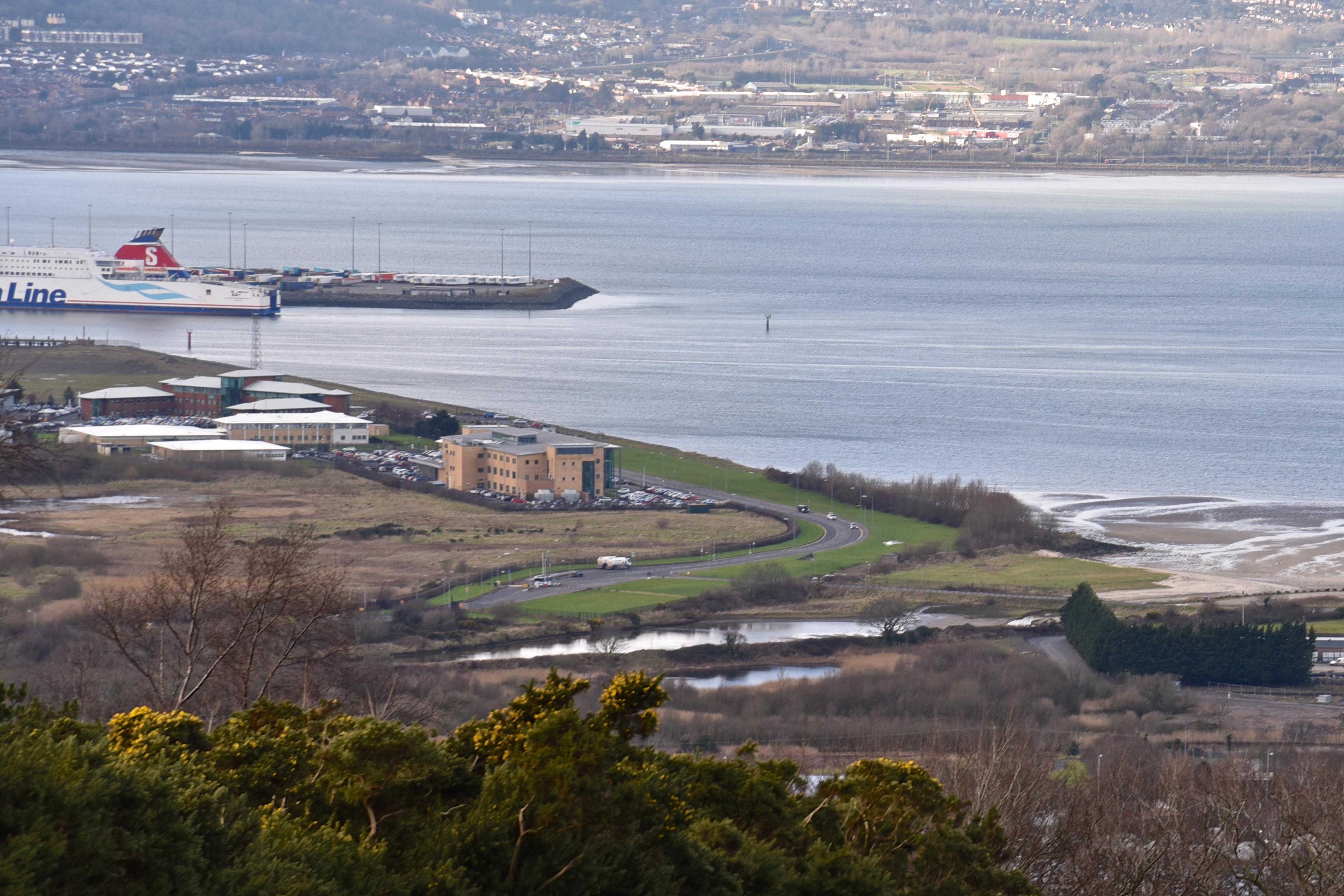 The building surrounded by cars in the first photo is Clare House, home to Northern Ireland’s Department of Finance. The Harbour Estate is filling up with offices like this. You can also find retail shops like IKEA and Sainsbury’s in the Holywood Exchange. The Belfast end of the townland is more industrial, with factories and storage facilities for Bombardier aircraft and Phoenix Gas.
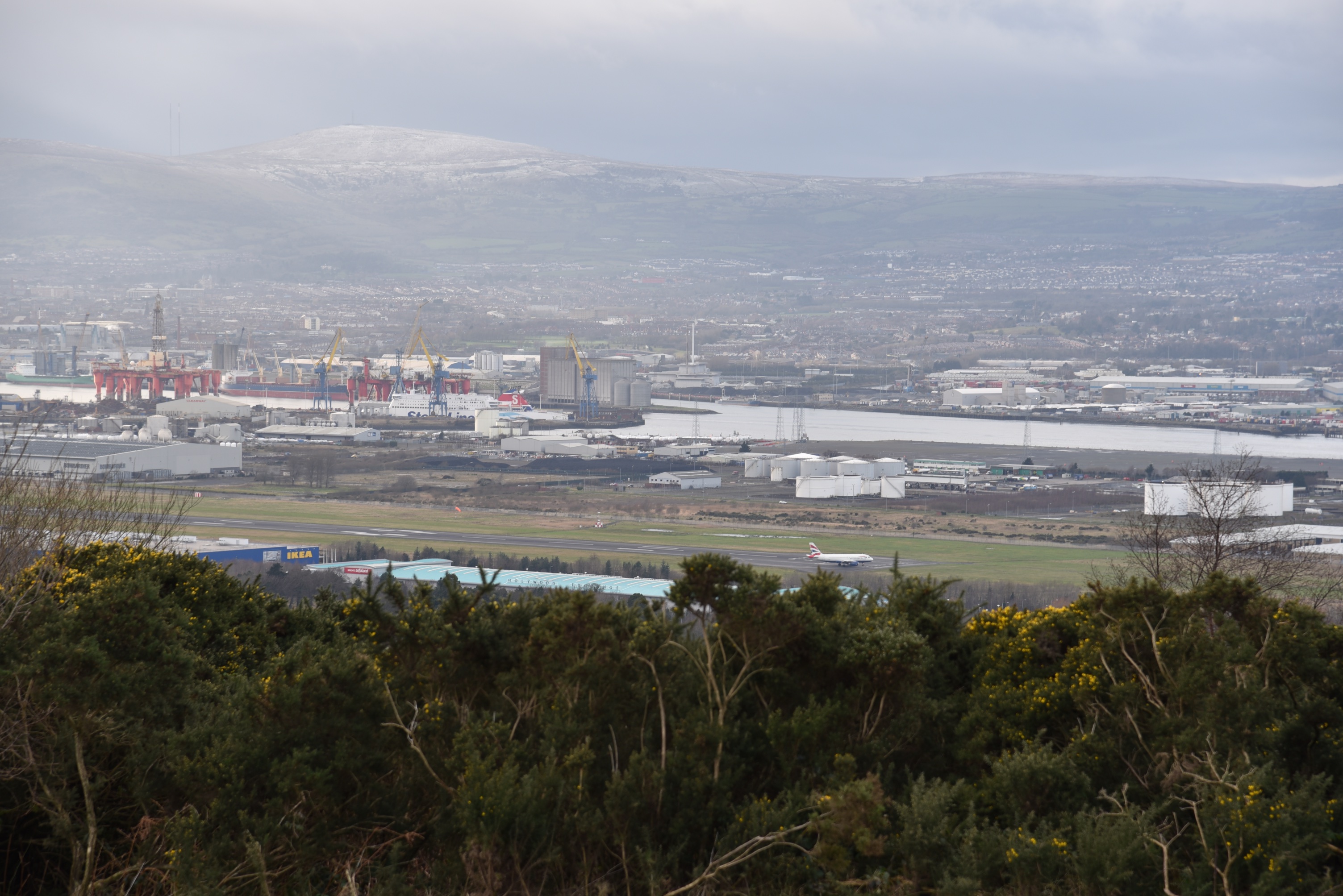 Sydenham Intake is the first townland seen by international visitors to Northern Ireland as they land at the airport, or disembark from cruise ships.
 The airport opened in 1938 as Belfast Harbour Airport, was known as Belfast City Airport for many years, and was renamed George Best Belfast City Airport in 2006, in memory of Northern Ireland’s most famous footballer.
 The process of dredging the lough and reclaiming land in Sydenham Intake has created a freshwater lagoon, now managed as a nature reserve by the Royal Society for the Protection of Birds (RSPB), under the name WOW! – Window on Wildlife.
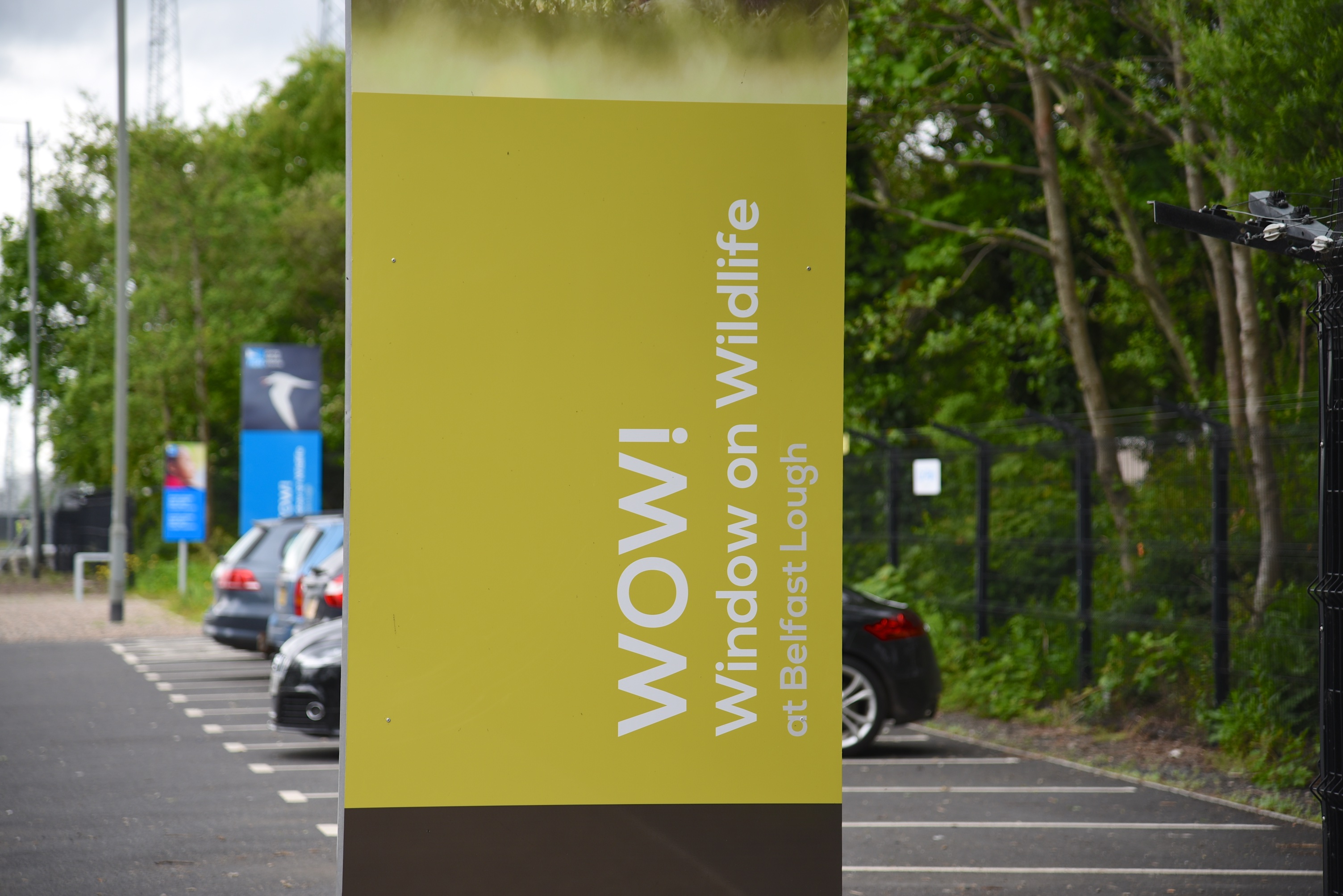 The best time to visit is at high tide, when birds in the lough are seeking a place to roost.
 There is a visitor centre with helpful staff who will show you how to use binoculars and telescopes, and help you identify birds. There are also two birdwatching hides, made from old shipping containers.
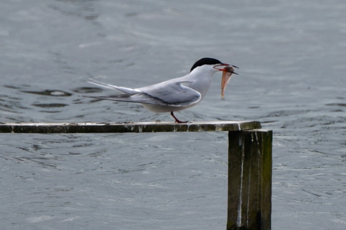
 On my visit in May 2016 I saw oystercatchers, black-tailed godwits, black-headed gull chicks, cygnets, coot chicks, a shoveller, and this common tern.
 Sydenham Intake doesn’t appear on any old maps, so what evidence do I have that it exists at all?
First, it has its own entry on the PLACENAMESNI website, which explains that “intake” is used in England to denote land reclaimed from a moor. In Northern Ireland, “intake” has a similar meaning, but is also used for land reclaimed from the sea or from lakes.
Second, it appears on the website for rates (a form of local taxation). Here is a screenshot from the Land and Property Services valuation list.

more information
Click here for a map of the townland on TOWNLANDS.IE.
Which county is Sydenham Intake in? County Down
Which townlands border Sydenham Intake? To the east, Holywood and Knocknagoney. To the south, Ballymaghan, Ballymisert and Strandtown.
WOW: RSPBNI’s Nature Reserve is open every day except Tuesday, from 10am to 5pm (February – October) or 10am to 4pm (November to January). Click here for more details.
Click here to read more about the history of George Best Belfast City Airport.
Finally, click here to read more about the name Sydenham Intake on the website of PLACENAMESNI.org.

Interesting stuff. I’ve never driven further than B&Q so I must check this area out soon. 🙂
LikeLiked by 1 person
Just keep driving on past B&Q and you’ll be surprised at how long the road is. Airport Road curls on and on, eventually taking you back to the Sam Thompson Bridge at Victoria Park, and the mini-roundabout at the H&W cranes, Dee Street bridge etc. The RSPB place is definitely worth a visit.
LikeLiked by 1 person
Thanks! I will 🙂
LikeLike
[…] Or skip straight to this month’s new posts: Gregstown, Sydenham Intake, […]
LikeLike
[…] townlands border Victoria Park? To the north, Sydenham Intake. To the east, Strandtown. To the south and west, Ballymacarret […]
LikeLike
[…] Which townlands border Ballymisert? To the east, Ballycloghan and Ballymaghan. To the south, Strandtown. To the west Sydenham Intake. […]
LikeLike
[…] townlands border Strandtown? To the north, Sydenham Intake. To the east, Ballycloghan and Ballymisert. To the south, Ballyhackamore and Victoria […]
LikeLike
[…] Which townlands border Ballymaghan? To the north, Knocknagoney. To the east, Killeen. To the south, Ballycloghan. To the west, Ballymisert and Sydenham Intake. […]
LikeLike