
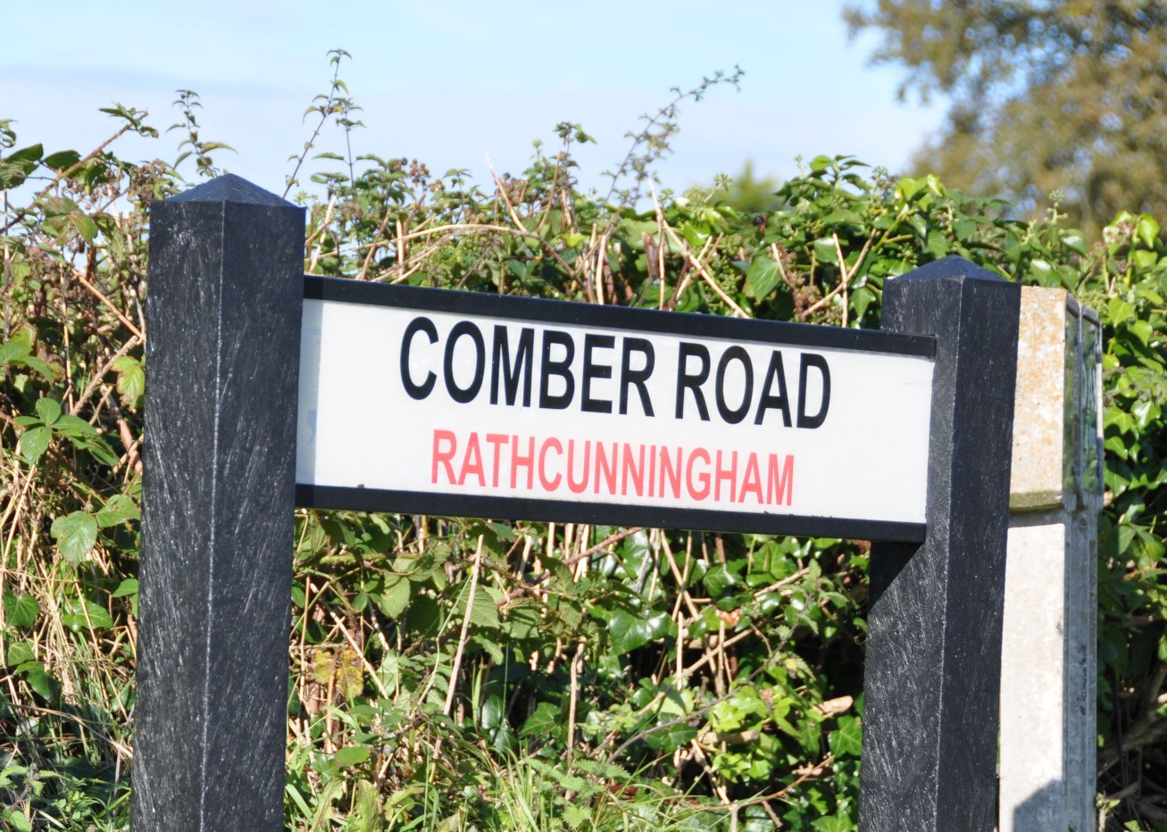
Today’s townland is Rathcunningham, in County Down, close to Strangford Lough. It lies north of the village of Killyleagh, bounded by Ringdufferin Road, the A22 Comber Road and Rathcunningham Road.
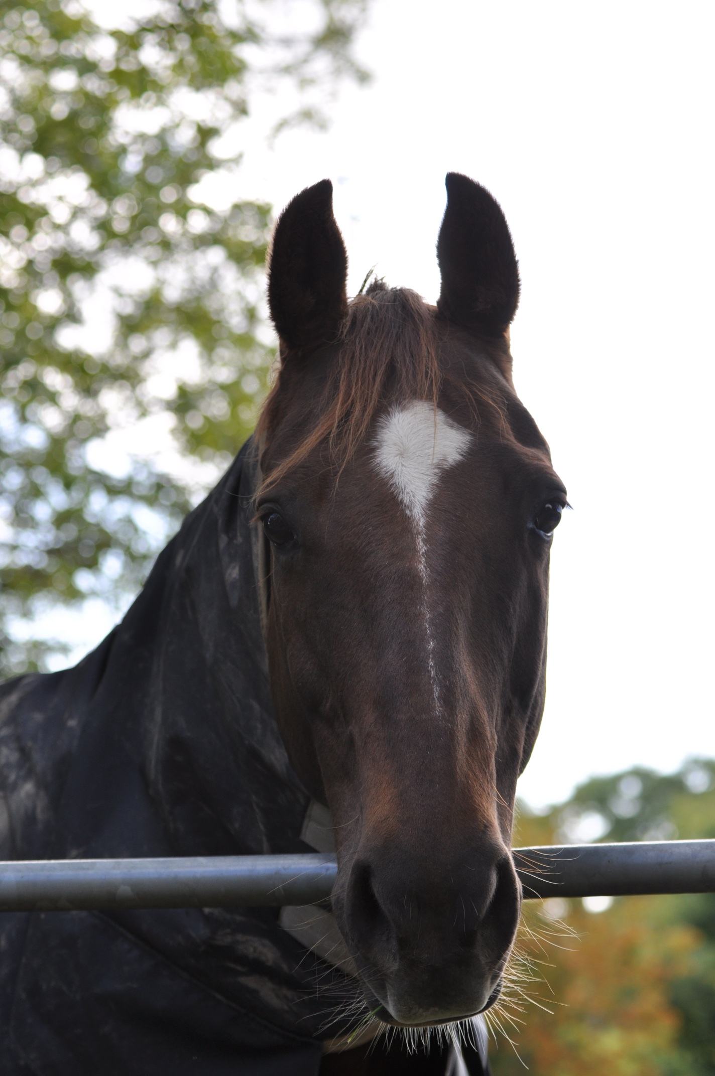
 Those roads are not the precise boundaries, because the townland extends into some fields south of Rathcunningham Road. That’s where I met this horse, friendly and warm in its jacket.
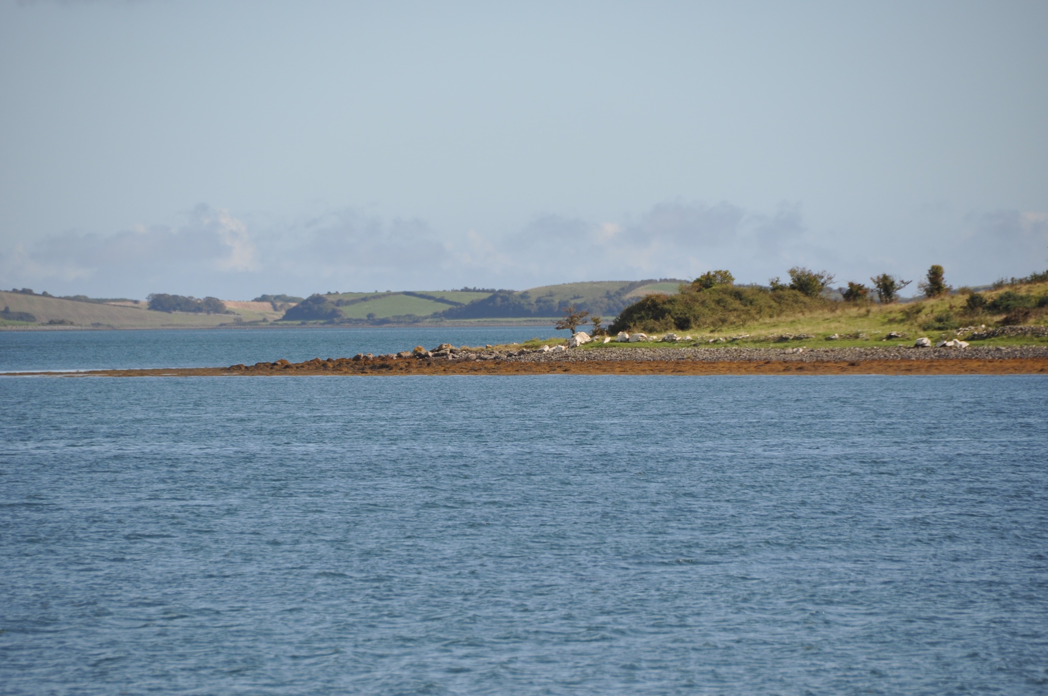
 Follow Rathcunningham Road to the end, and you reach the shore of Strangford Lough, with a view out to Island Taggart, and the Ards Peninsula beyond.
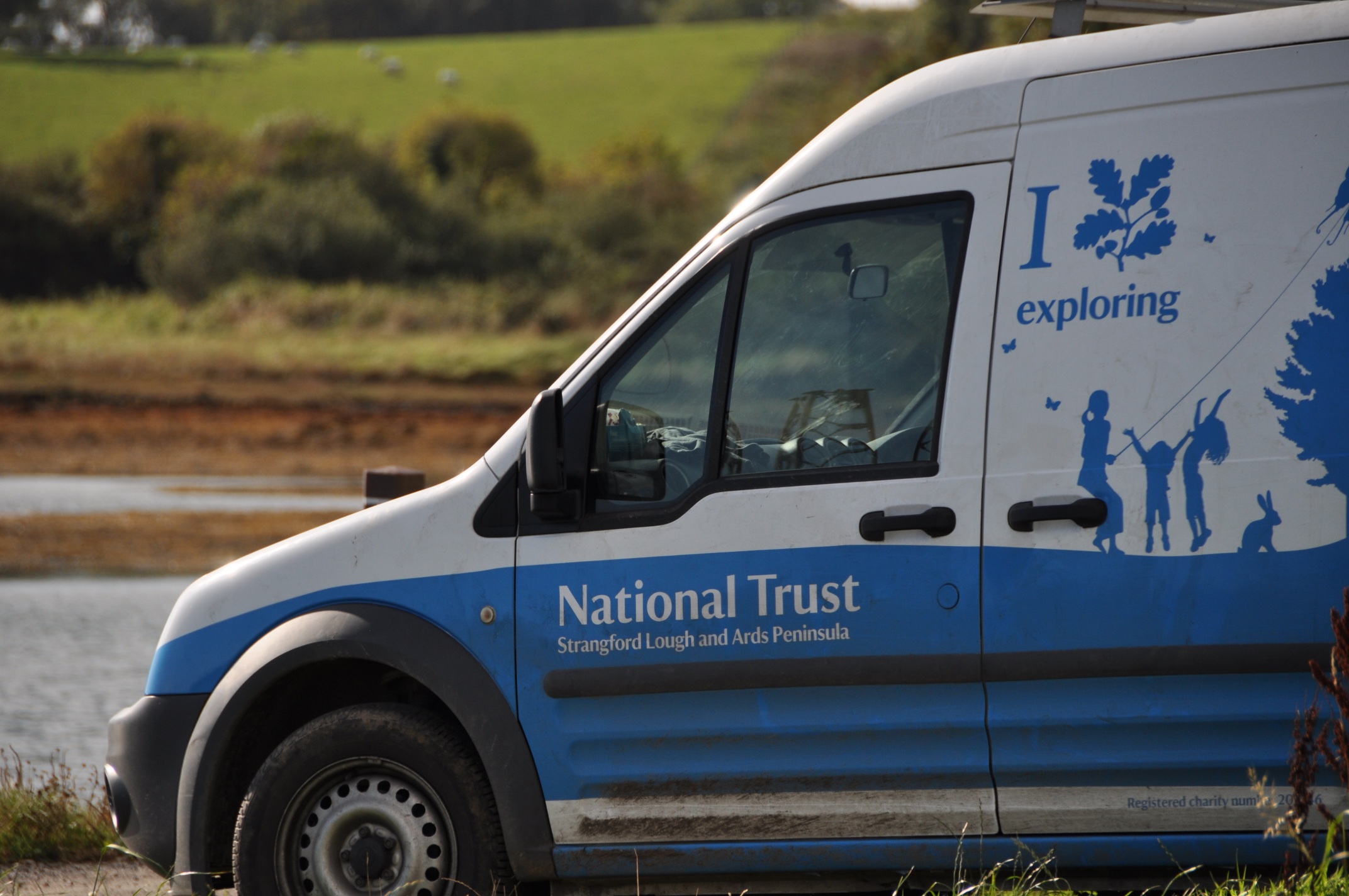
 Island Taggart is owned by the National Trust, which might explain the presence of this vehicle at the quayside in Rathcunningham.
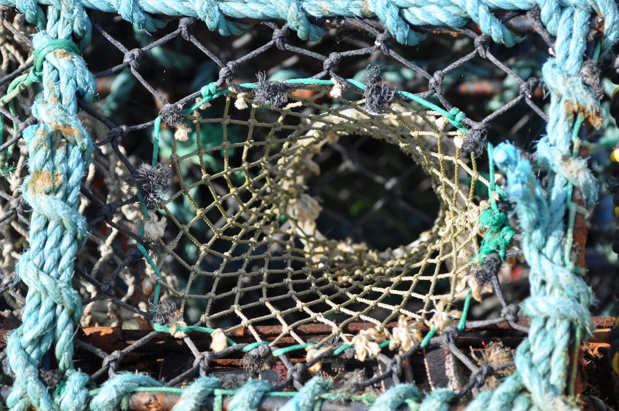
 The quay was piled high with creels for catching shellfish.
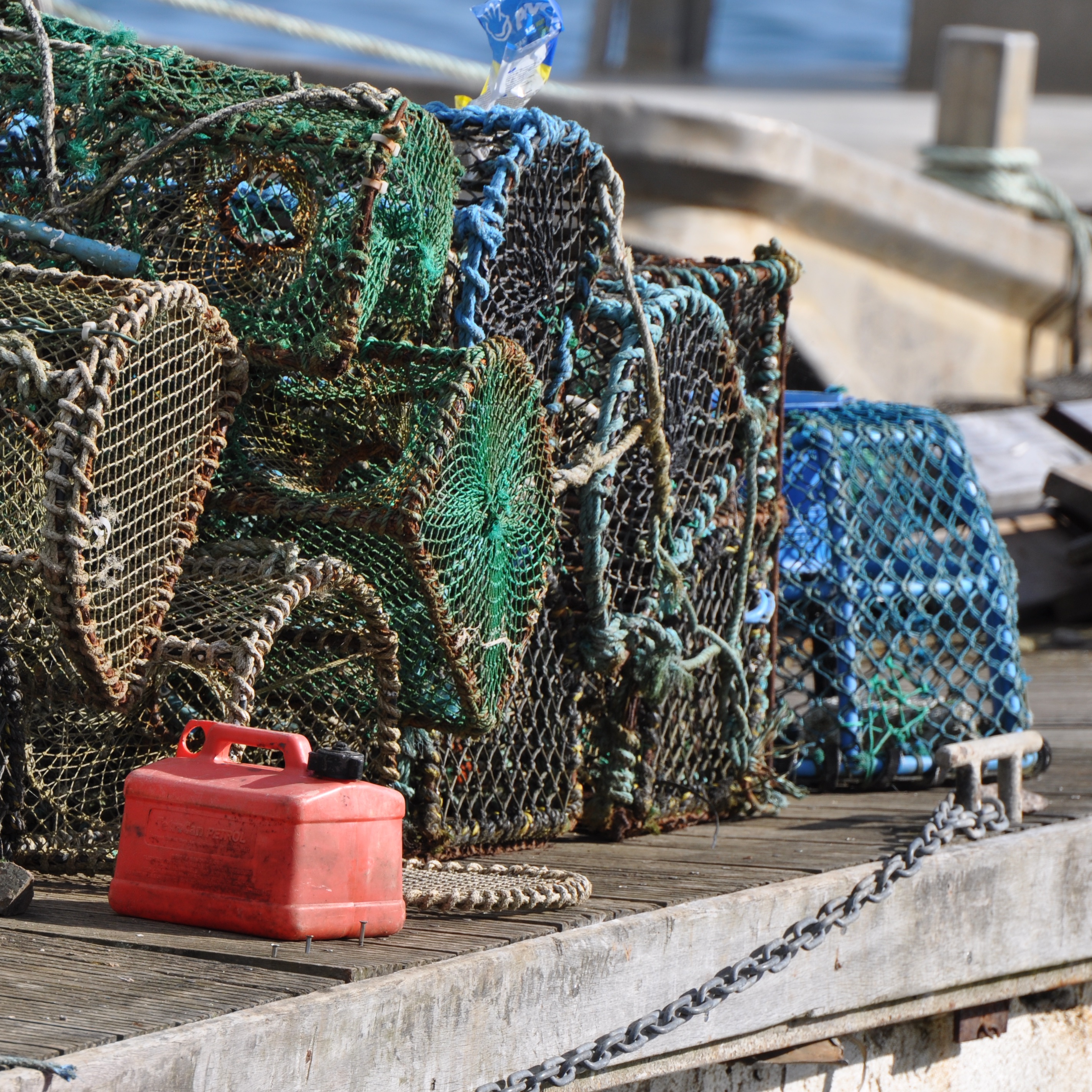 In recent years fishing on the lough has been restricted in an effort to save the horse mussel reefs on the seabed. The importance of the horse mussels is explained by the Ulster Wildlife Trust-
“Horse Mussel communities have been a dominant feature of the seabed of Strangford Lough…, and form clumps, or reef-like structures that over 100 other species rely upon to live within and around. Without the Horse Mussel communities, the seabed is mostly a muddy bottom, upon and within which much fewer species can exist.”
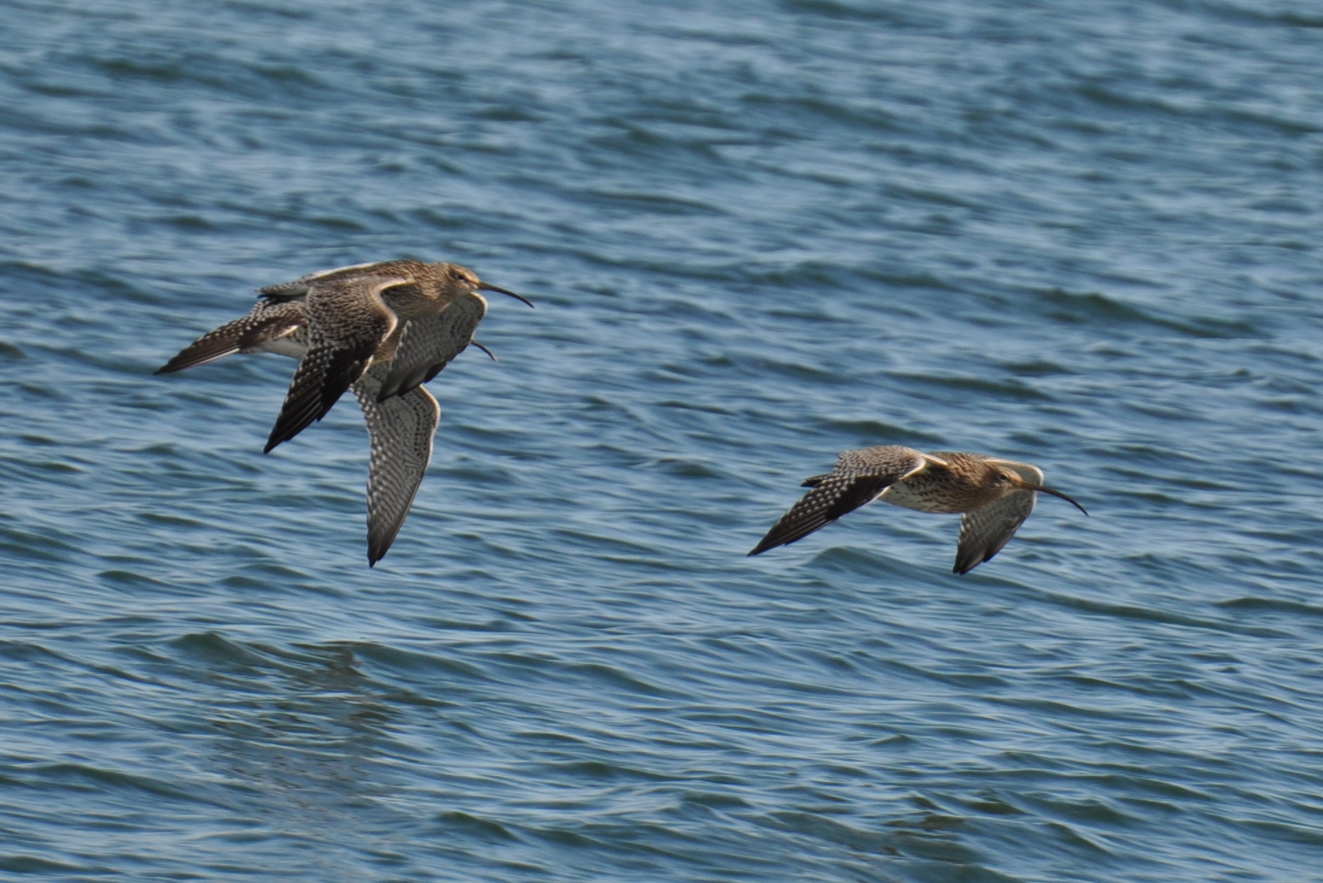
 There are no such restrictions on fishing by curlews. These birds are probably winter visitors. There has been a steep decline in the number of curlews living and breeding in Ireland.
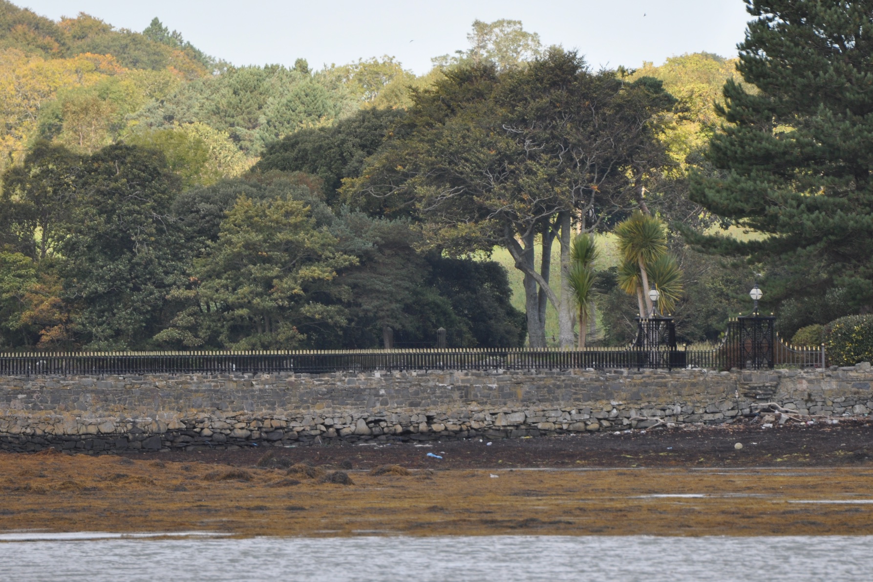
 The townland of Rathcunningham includes Simmy Island, a small island in the lough, reached by a causeway. Simmy is privately owned, so even though I share the motto on the National Trust van of “I love exploring”, I haven’t entered these impressive gates and railings.
 Where does the name Rathcunningham come from? According to the PLACENAMESNI website, it probably comes from the Irish Ráth Cheanndubháin meaning “Canavan’s fort”. The “rath” part refers to a fort on the hill above the quay. The second part of Rathcunningham is a surname, but a misleading one. Maps of 1625 began a tradition of spelling the townland name as if it contained the Scottish surname Cunningham, instead of the Irish surname Canavan.
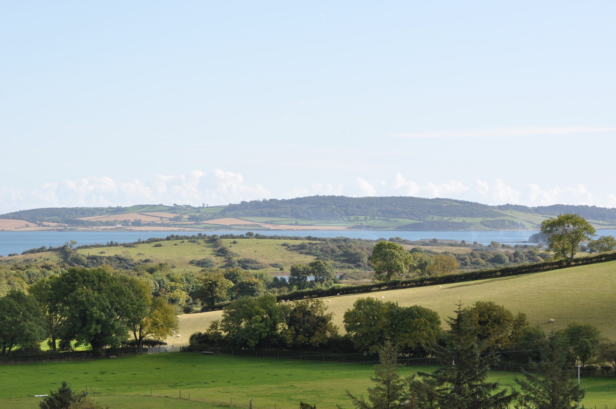
I’m going to be a bit vague about my final photo. I had driven on to the next townland, but turned round to enjoy the view back towards the lough. I hope you enjoy the pretty scene and don’t ask me to tell you which fields are in Rathcunningham and which are in Moymore.
MORE INFORMATION
Concerned about curlews? Click here to read the leaflet produced by Birdwatch Ireland.
Concerned about shellfish, and about the people who make a living on the lough?
For a shorter guide to the long-running saga of horse mussels and EU fines, click here to read an article by Linda Stewart published in the Belfast Telegraph on 1 April 2015.
Which other townlands border Rathcunningham? To the north, Ringdufferin, Ballymacromwell, and Kirkland & Toy. To the west, Tullymacnous. To the south, Moymore. To the east, the lough.
Which civil parish is Rathcunningham in? Killyleagh.
Which council area is Rathcunningham in? Newry Mourne and Down District Council
Which county is Rathcunningham in? County Down

[…] skip straight to this month’s new posts: Rathcunningham, Ballyreagh, Commons […]
LikeLike
Fascinating Karolyn. I hadn’t heard of horse mussels. Lovely post.
LikeLike
[…] Ringdufferin? To the north Ballymacarron. To the west, Ballymacromwell. To the south, Rathcunningham. To the east, nothing but […]
LikeLike
On a weekend break. Beautiful views of Strangford Lough. Lovely to hear the curlews. Wondering if birdwatch Ireland have a viewing hut off Rathcunningham Road.
LikeLiked by 1 person