
Carrowreagh is the name of 33 townlands in Ulster and Connaught, but for this post I’m exploring the one in Dundonald, County Down.
This townland covers a large, mixed area. Residential streets sprawl across the first third of Carrowreagh, and are, confusingly, part of Ballybeen Estate.
 A school stands next to the housing estate, but it doesn’t bear the townland name. Carrowreagh school disappeared when it amalgamated with Ballyoran to form Brooklands Primary School in 1985.
The middle third of the townland is the trading and business hub. Again the townland names cross over, with a street called Ballyoran Lane in Carrowreagh townland. When I need to clear my head of townland confusion I relax and my friends’ café – the Village Kitchen.

The final third of Carrowreagh is hilly and rural. Here are two photos of the top of the Carrowreagh Road, showing the explosion of blossom in the gorse between the beginning of April and the end of May.


The hills are home to sheep and, in early July, these cows.
 Some of the land on this hill is owned by the Blakiston Houston Estates. Click here to read more about the Blakiston Baronets, and here to read an extract from the memoirs of Lieutenant-Colonel John Matthew Blakiston-Houston.
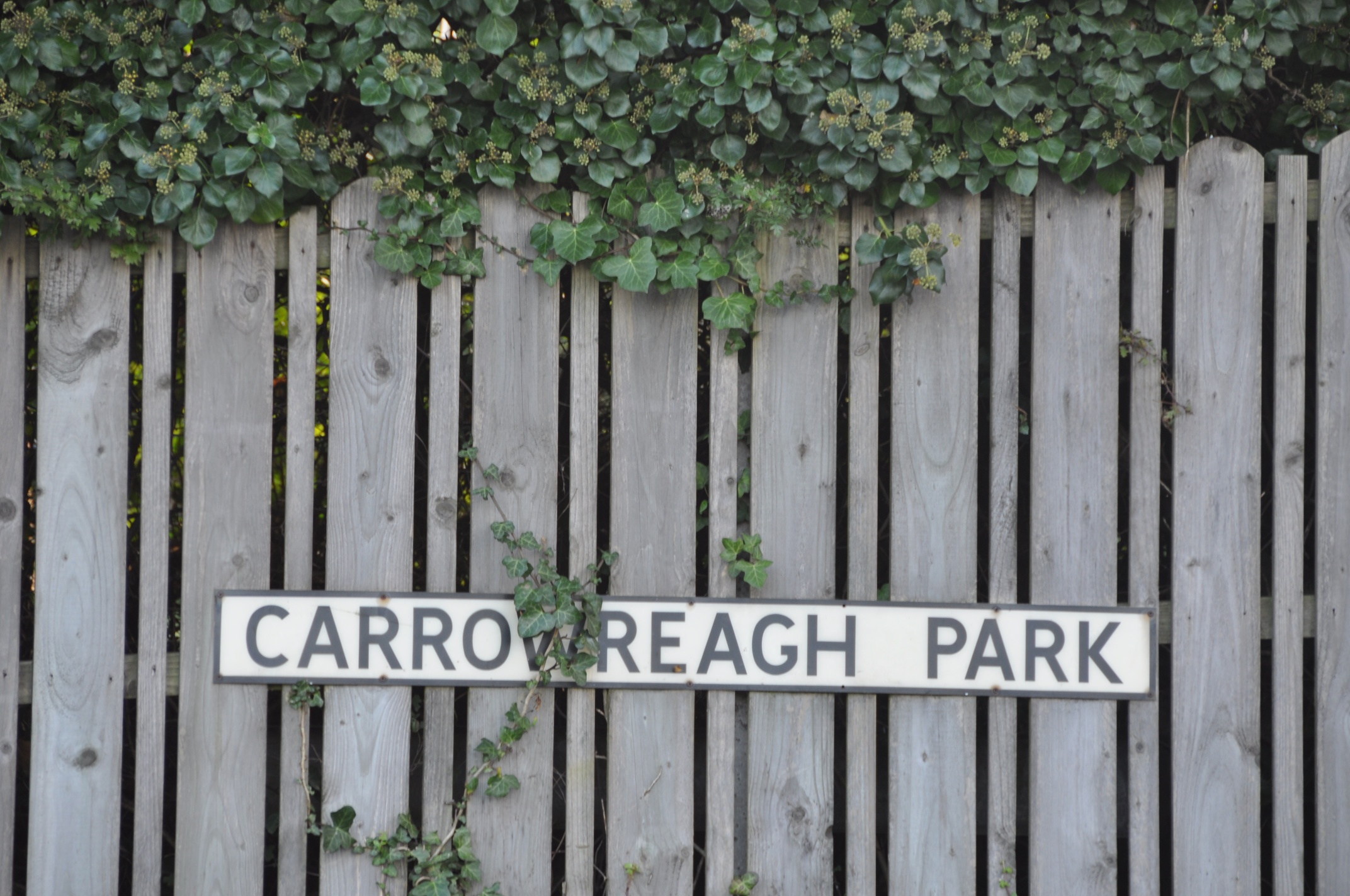
 According to my usual source, the PLACENAMESNI website, the name Carrowreagh derives from the Irish An Cheathrú Riabhach meaning “the grey or speckled quarter(land)”. I went in search of grey or speckled things, and found this fence.
more INFORMATION
Which townlands border Carrowreagh? Ballybeen, Ballyoran, Craigogantlet, Dunlady, Greengraves, Killarn.
Which parish is Carrowreagh in? Dundonald.
Which county is Carrowreagh in? County Down.
CLICK here to see a map of Carrowreagh on the PLACENAMESNI website.

[…] the townland. This month I have added posts about: BALLYMACRUISE BALLYCULTRA CARROWREAGH CORPORATION […]
LikeLike
The road looks lovely, would be great for a bicycling tour I think 🙂
LikeLike
Yes, if you have strong legs. The hill is steep, but the views from the top are spectacular.
LikeLike
It seems a bit odd having 33 speckled grey quarters. Could there be a different derivation?
LikeLike
It’s been raining all day. I have no difficulty believing that this whole island is grey.
LikeLiked by 1 person
[…] with Bangor parish is Ballysallagh Major. Go down the western side of the hills and you reach Carrowreagh and Dunlady in Dundonald parish. Move north into Holywood parish and the next townlands are […]
LikeLike
[…] lies to the south of Craigantlet and east of Carrowreagh, and includes some of the fields in the middle of this photo taken from the Carrowreagh […]
LikeLike
[…] Which townlands border Ballylisbredan? Moving clockwise, from Ballyoran in the north, the neighbouring townlands are Greengraves, Ballyrainey, Ballyrussell, Ballymaglaff, Ballybeen, and a sliver of Carrowreagh. […]
LikeLike
[…] townlands border Ballyoran? To the north and west, Carrowreagh. To the east, Greengraves. To the south, […]
LikeLike
[…] Which townlands border Greengraves? To the north, Killarn. Then moving clockwise, Ballyrogan, Ballycullen, Ballyalton, Ballymagreehan, Ballyrainey, Ballylisbredan, Ballyoran and Carrowreagh. […]
LikeLike
[…] Road – but none of them form townland boundaries. The townlands of Ballyregan, Dunlady and Carrowreagh are divided by the rivers in the valleys, not the roads on the […]
LikeLike
[…] According to the PLACENAMESNI website, the name of this townland comes from the Irish An tOileán Riabhach meaning “the brindled island”. I’m getting familiar with that word riabhach and maybe so are you, as it has appeared in the other brindled, grey, and speckled townlands of Moneyreagh and Carrowreagh. […]
LikeLike