
This is the first post for my Townlands of Ulster website.
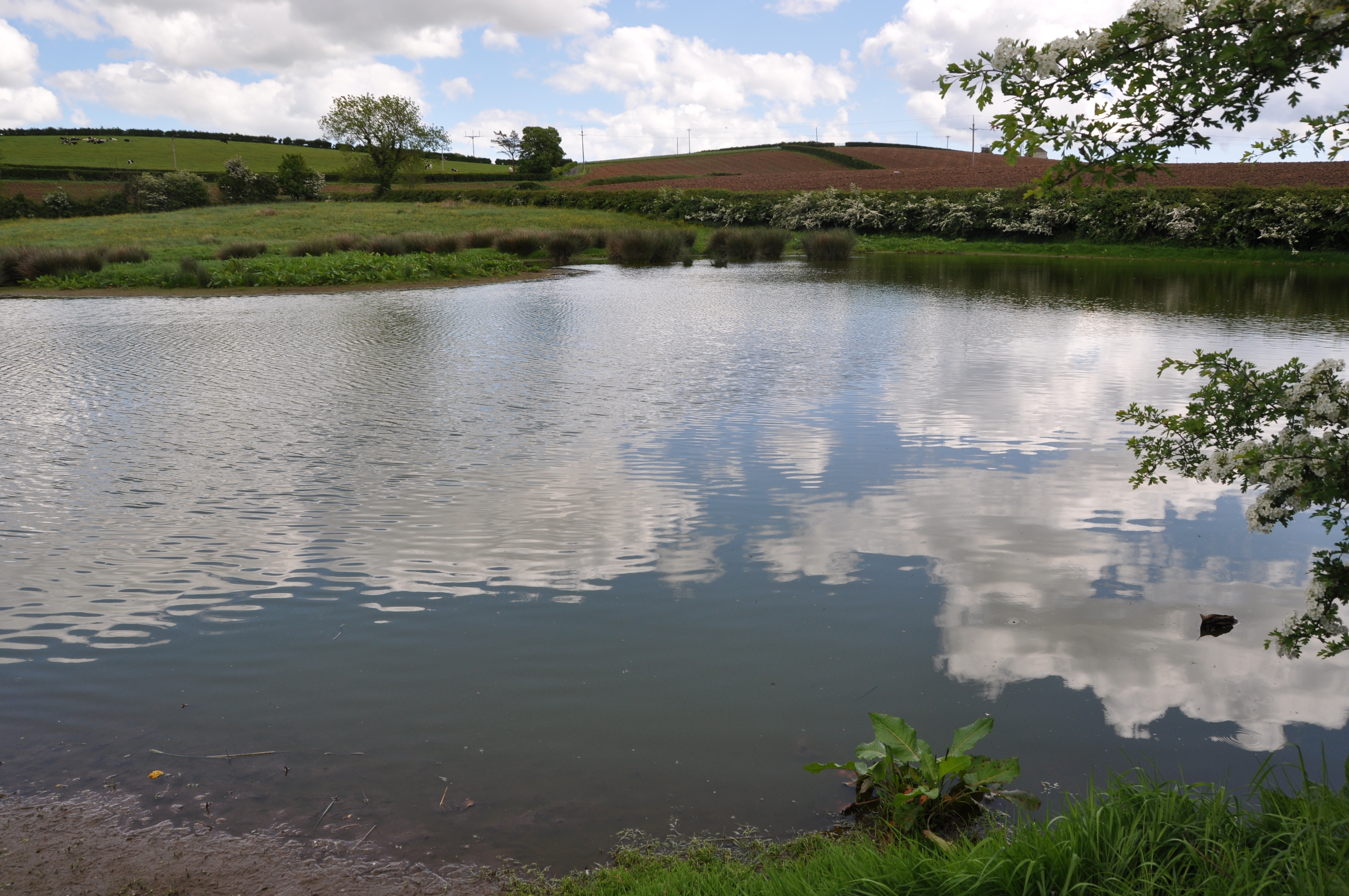
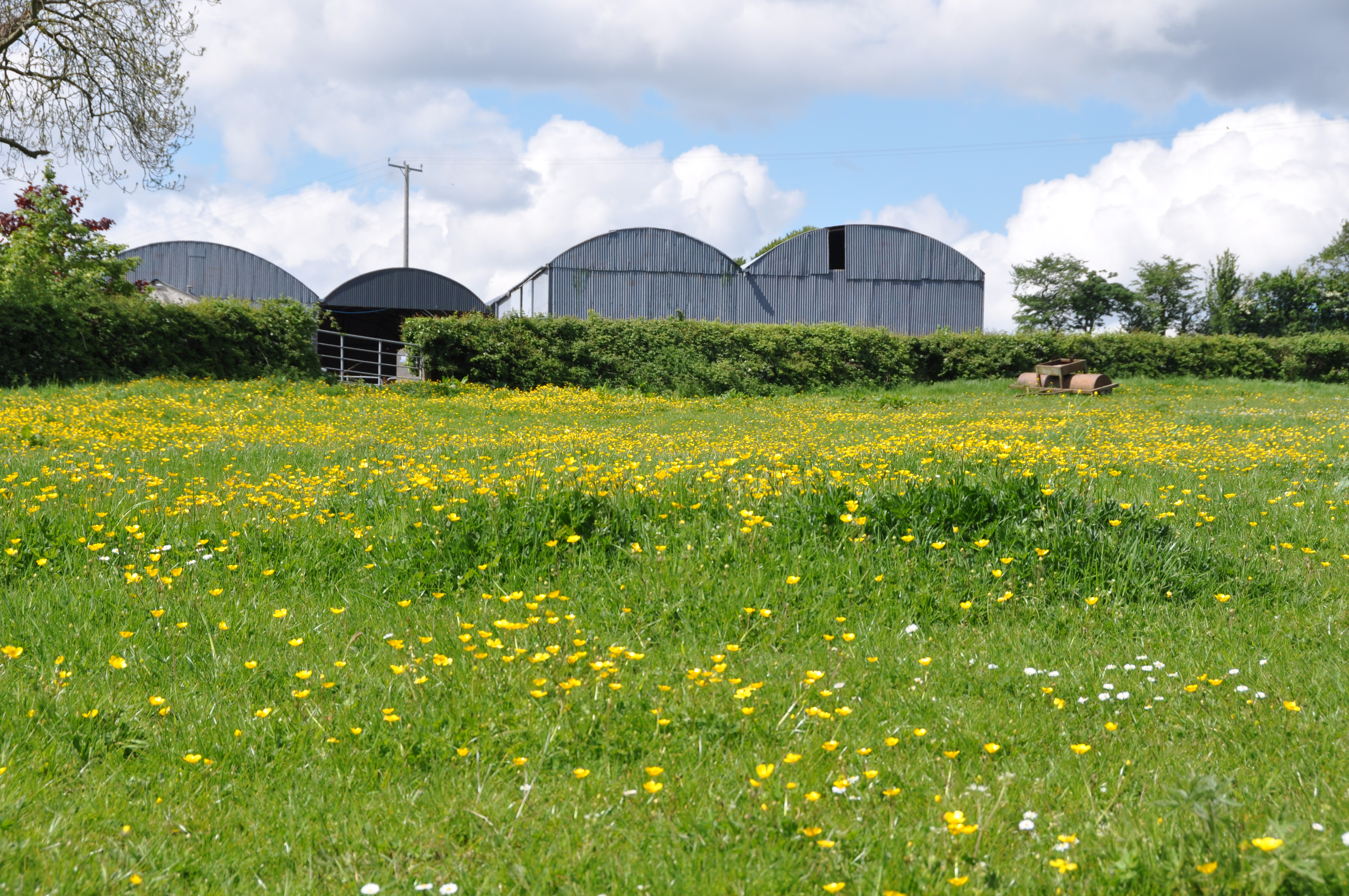 The blog had to start somewhere….and where better than Ballylisbredan? It’s close to home, and covers some beautiful farmland between Dundonald and Comber in County Down.
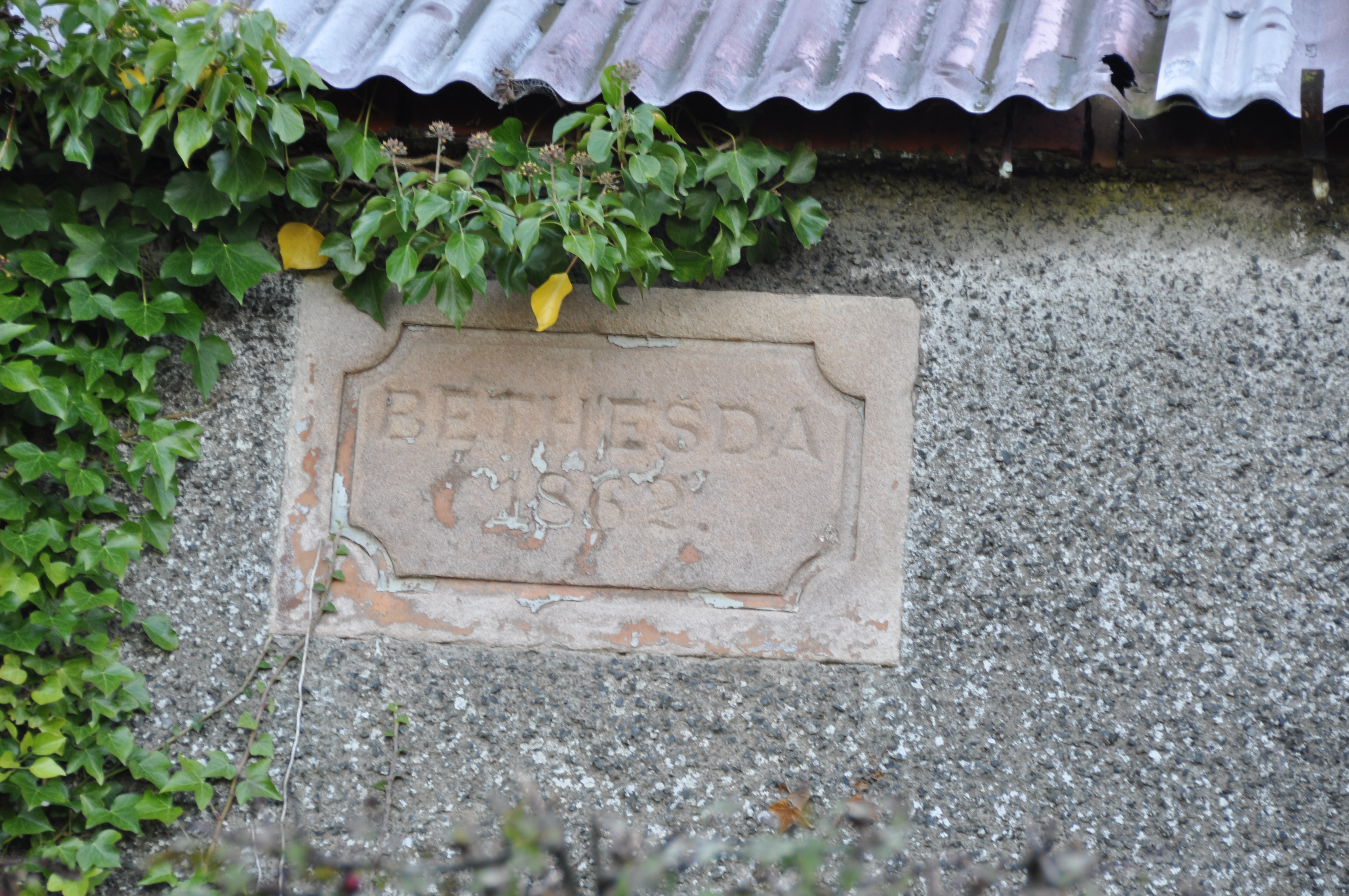
 I haven’t found any road signs yet for this townland, mainly because there are very few roads in Ballylisbredan – just the Greengraves Road, really. I wonder if it’s also because signwriters couldn’t agree on the spelling.
According to the PLACENAMESNI website, the name Ballylisbredan is derived from the Irish “Baile Lios Bradáin” meaning “townland of Bradán’s fort”. Then they list about a dozen different spellings, peaking in length in 1644 with Ballelisdrumbraden, which is just a bit excessive.
So instead here is a more concise sign on a disused church building known locally as “Bethesda”.
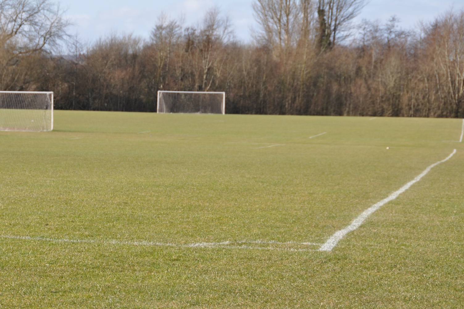
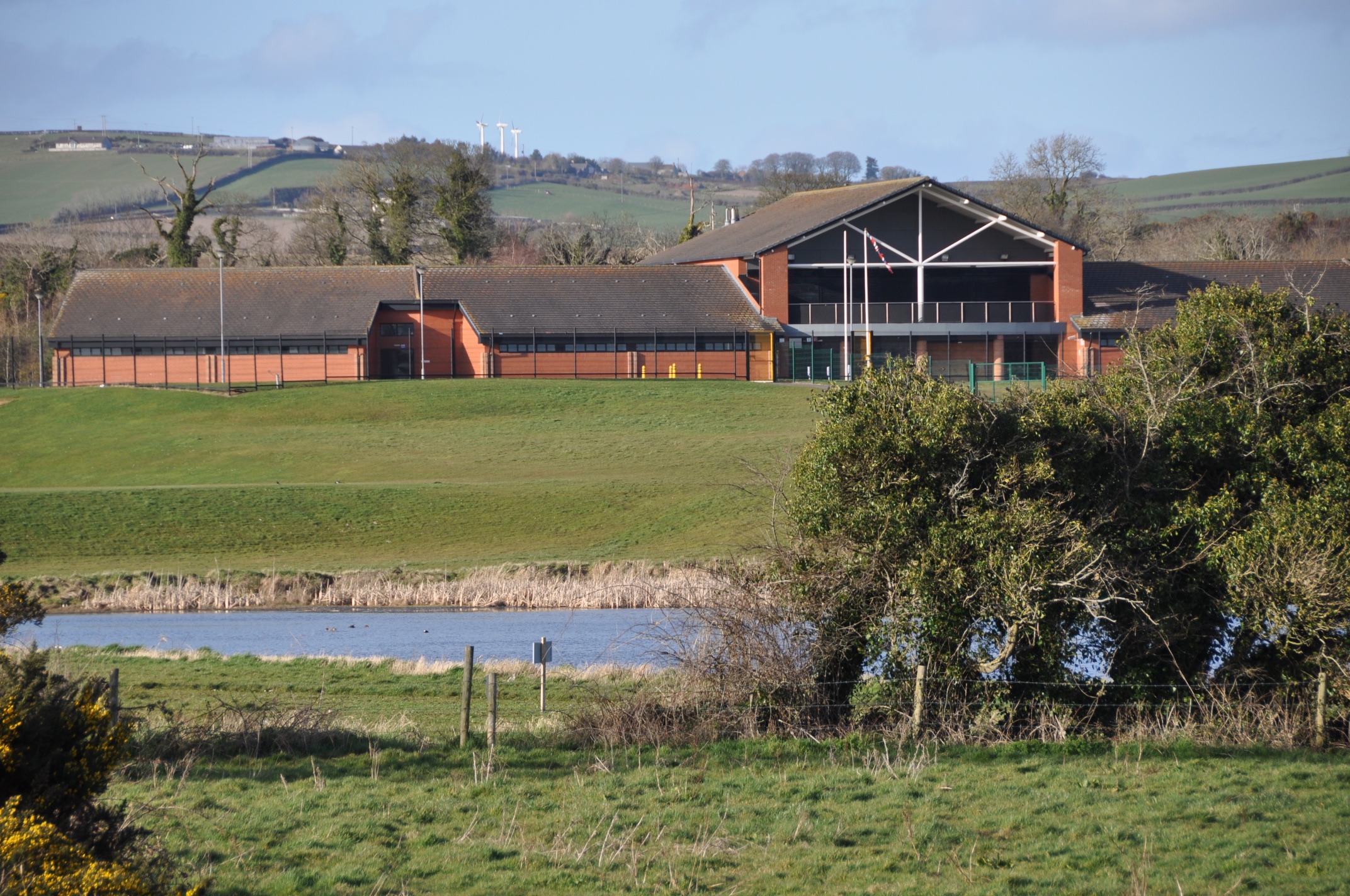
 Ballylisbredan extends southwest to the Billy Neill playing fields – also mentioned in my post about Ballyrussell.
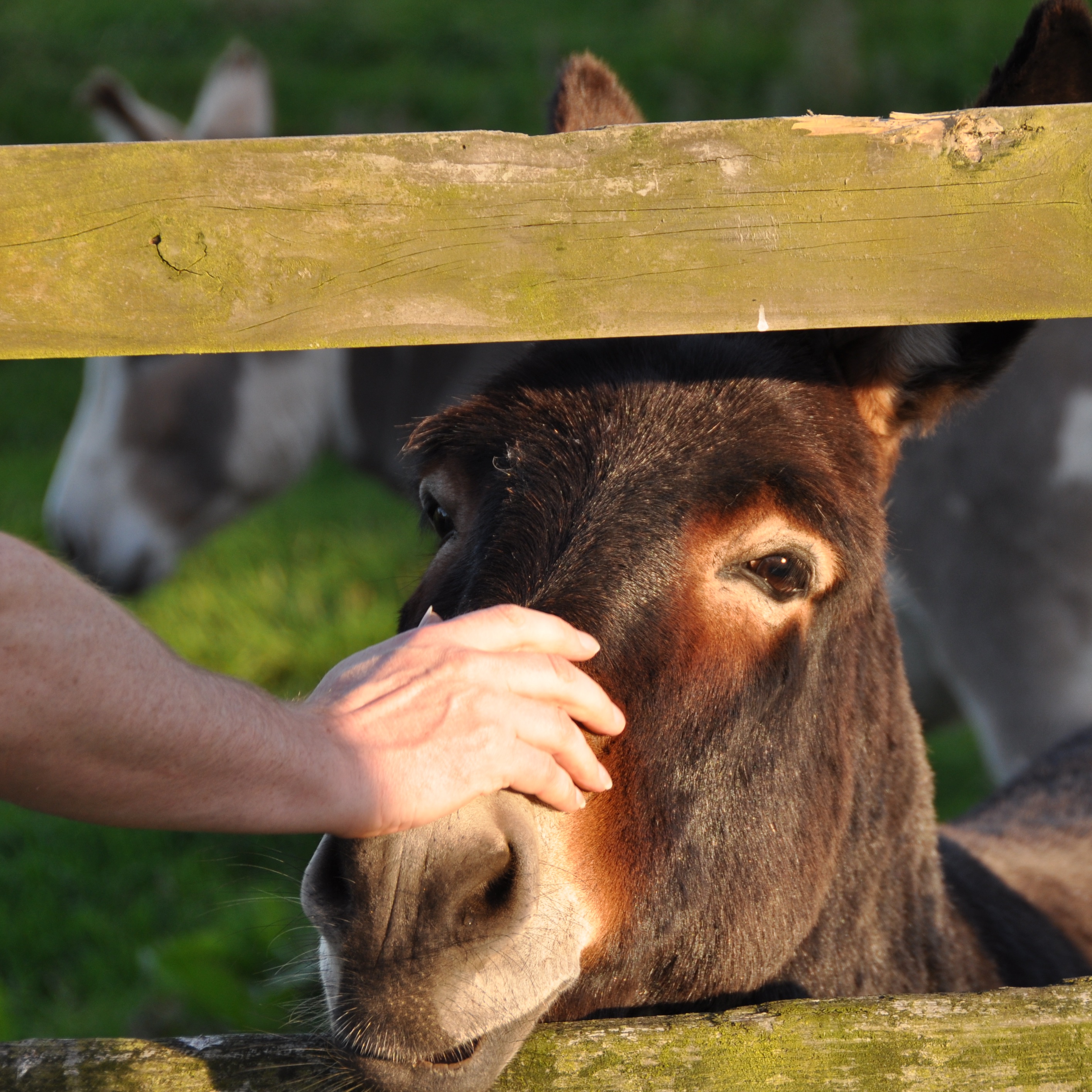
 ONE YEAR LATER: I’m updating this post in October 2015. To celebrate my website’s first anniversary, I couldn’t resist adding a photo of my favourite residents of Ballylisbredan – my brother and the donkeys.
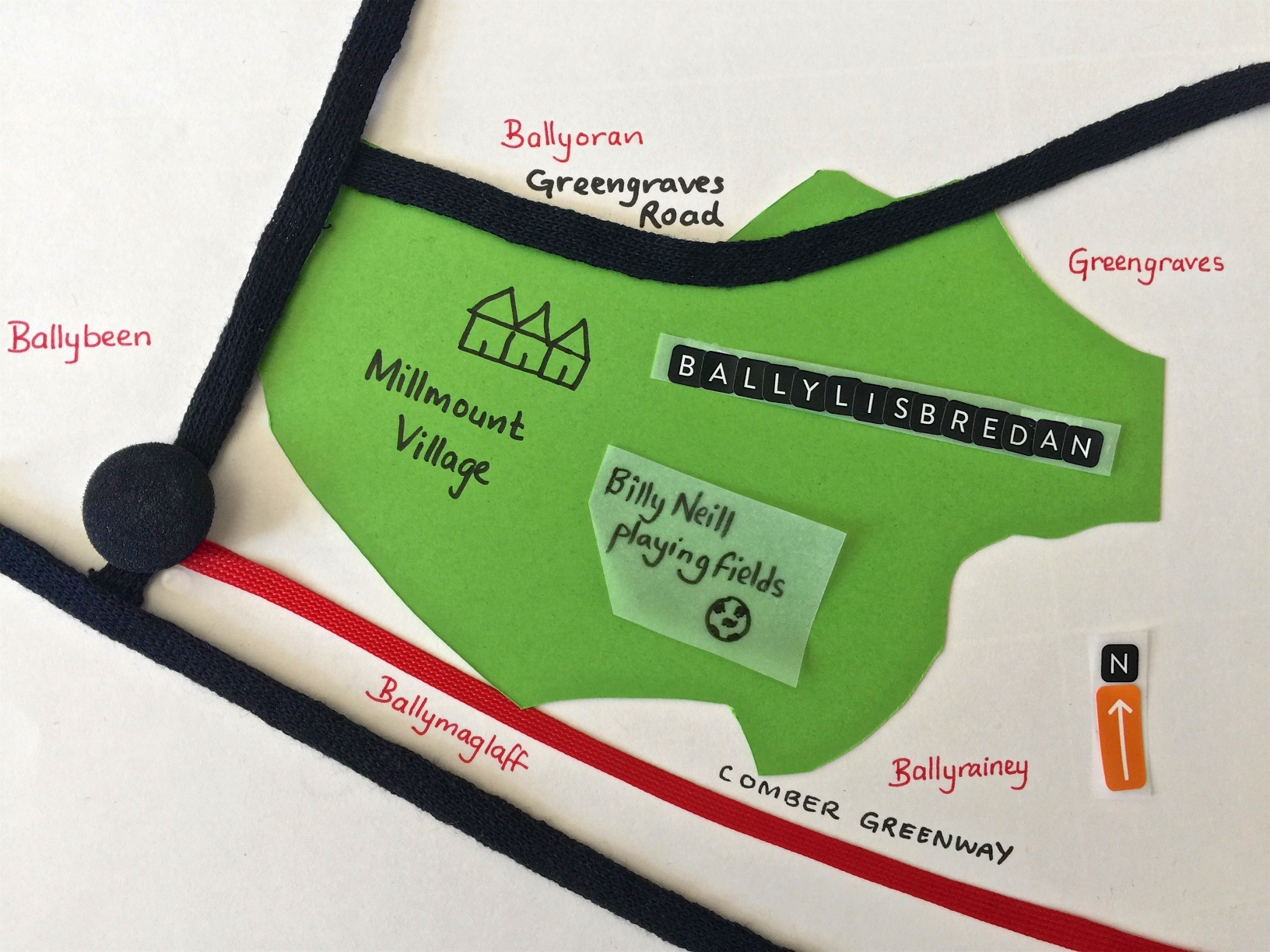
 UPDATE: THREE YEARS LATER: Readers have been asking me for maps, so here is a sketch map of Ballylisbredan. Since first writing about Ballylisbredan back in 2014, I’ve watched the housing development called Millmount Village spread across the townland.
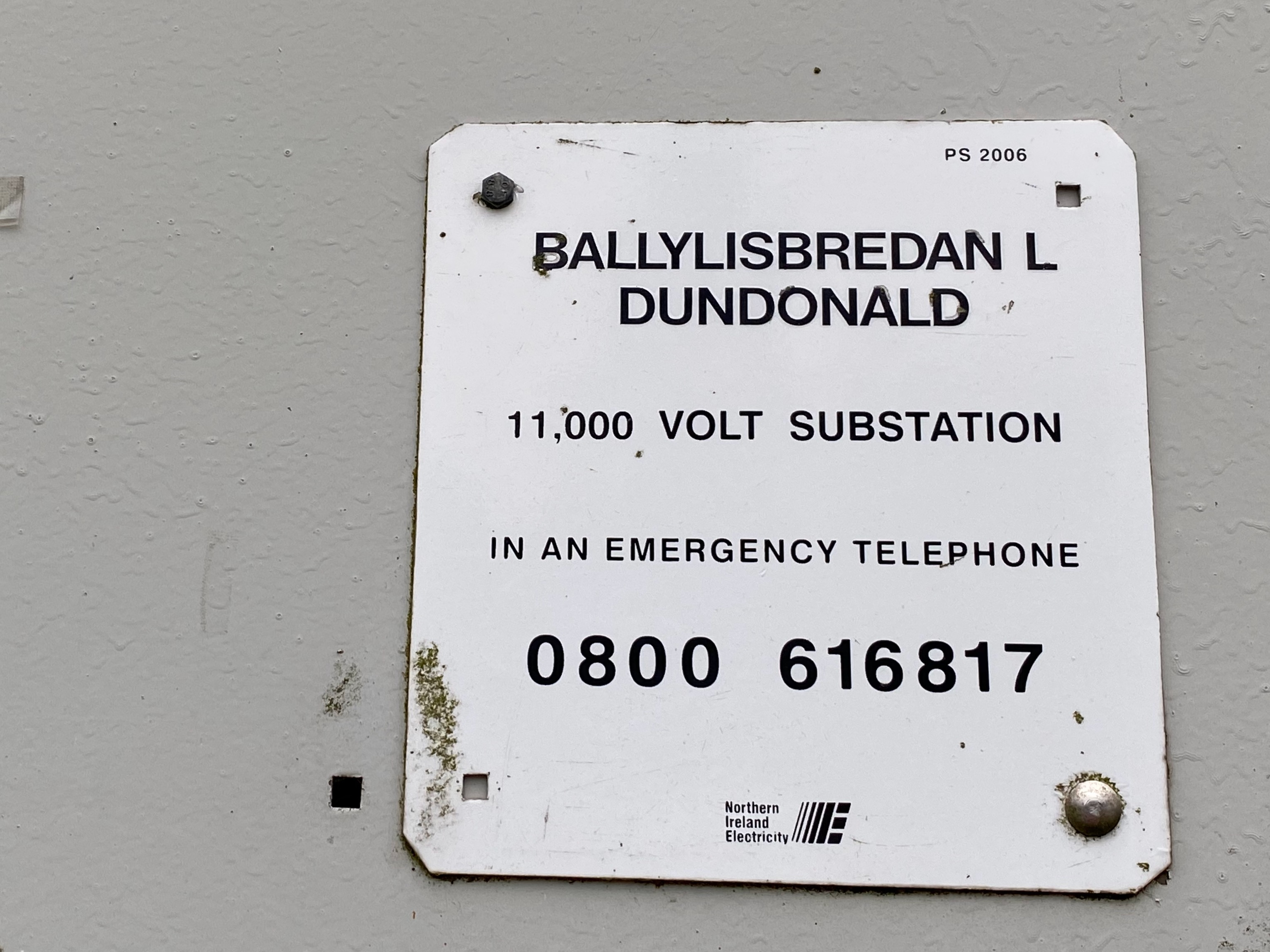
UPDATE IN 2020: At last, I’ve found an official example of the name of this townland on the side of an electricity substation. This is located beside the football pitches in the recently renamed Billy Neill Country Park.
more information
Which townlands border Ballylisbredan? Moving clockwise, from Ballyoran in the north, the neighbouring townlands are Greengraves, Ballyrainey, Ballyrussell, Ballymaglaff, Ballybeen, and a sliver of Carrowreagh.
Which parish is Ballylisbredan in? Dundonald
Which county is Ballylisbredan in? County Down
Which council area is Ballylisbredan in? The lower part is in Lisburn and Castlereagh City Council. As you move uphill along the Greengraves Road, you move into Ards and North Down Council’s area.
Click here for a more detailed map than I’ve managed in my sketch, on the Townlands.IE website.
CLICK here read more about the history of the name Ballylisbredan on the PLACENAMESNI website.

[…] close to home, with the townland of Ballylisbredan being the subject of my first blogpost. (Click here to read that […]
LikeLike
There is a place called Bethesda in north west Wales.
LikeLike
[…] there just weren’t that many towns. Even today, the places in my first blogposts, like Ballylisbredan and Ballyministragh, are rural areas, with scattered farmhouses. So it’s more likely that […]
LikeLike
[…] Then, as you may have seen in recent posts, I went walking on the Comber Greenway. Starting from from Comber, Ballymaglaff is the fifth townland on the Greenway. At the Billy Neill football pitches, you leave Ballyrussell and enter Ballymaglaff, with the Enler River forming the boundary with Ballylisbredan. […]
LikeLike
[…] BALLYLISBREDAN […]
LikeLike
[…] early posts were sketchy, and I had little to say about the first three townlands of Ballylisbredan, Ballyministragh and Scrabo. This week I have added new material to build those posts up into […]
LikeLike
[…] Which townlands border Ballyoran? To the north and west, Carrowreagh. To the east, Greengraves. To the south, Ballylisbredan. […]
LikeLike
[…] Then moving clockwise, Ballyrogan, Ballycullen, Ballyalton, Ballymagreehan, Ballyrainey, Ballylisbredan, Ballyoran and […]
LikeLike
[…] townlands border Ballyrainey? Moving clockwise, from Ballylisbredan in the north, the neighbouring townlands are Greengraves, Ballymagreehan, Ballyalton, Unicarval, […]
LikeLike
[…] If you like the sketch map, let me know. I have added maps to some older blogposts, beginning with Ballygrot and Ballylisbredan. […]
LikeLike
[…] My photographs start about 24 minutes into the meeting. If you follow my blog, you will recognise most of the images. The picture behind me in this screenshot is the townland of Ballylisbredan. […]
LikeLike
I enjoy learning about local townlands and their histories.
LikeLiked by 1 person