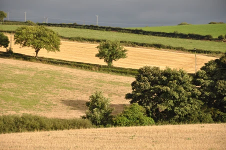
Today’s townland is Dunlady, County Down.
 Dunlady spreads out across the hillside north of Dundonald.
 Three roads climb the hills – Ballyregan Road, Dunlady Road and Carrowreagh Road – but none of them form townland boundaries. The townlands of Ballyregan, Dunlady and Carrowreagh are divided by the rivers in the valleys, not the roads on the ridges.
 On the subject of divisions, I kept up my interest in gates and fences, with this wooden fence from Dunlady.
 Dunlady is a hilly townland. In 2006 the Environment Agency described this area in more technical terms-
“The Craigantlet Escarpment is a prominent ridge of Silurian rocks which forms the escarpment to the Holywood Hills. The escarpment encloses and shelters the urban edge of east Belfast which pushes up against the ridge.”
What can you do with high ground like that? (1) Graze sheep.
 According to the PLACENAMESNI website, the most satisfactory interpretation of the origin of the name Dunlady is the Irish “Dún Léide” meaning ‘Léide’s fort’.
The vowels in the townland name are hard to pin down. The local pronunciation definitely does not sound like “lad”. It’s somewhere between “led” and “laid”. If you look carefully at this gravestone in Dundonald churchyard, you can see different spellings from 1909 and 1930, neither of which match the current form.
 Just before it reaches Craigantlet, the Dunlady Road dips down to a stone-walled bridge, which I’ve seen named on an old map as “Murder Bridge”. Does anyone know how this bridge got its dramatic name? I would love to know.
MORE INFORMATION
Click here for a map of Dunlady on Townlands.IE.
Click here for a link to a 19th century map of Dunlady on the website of Ordnance Survey Ireland. This map marks “Murder Bridge”.
Which civil parish is Dunlady in? Dundonald. There are eleven townlands in Dundonald, of which I’ve posted nine to this website. That just leaves two – Castlebeg (near Comber) and Killeen (near Stormont).
Which townlands border Dunlady? At the bottom of the hill, it borders Ballybeen. Rising uphill, it is located between Ballyregan and Carrowreagh. At the top of the hill you reach Craigogantlet, Ballymenagh and a corner of Ballykeel.
Which council area is Dunlady in? Lisburn and Castlereagh City Council.
Which county is Dunlady in? County Down
And finally, click here to read about the townland’s name on PLACENAMESNI.ORG.


[…] skip straight to this month’s new posts: Dunlady, Miller Hill, […]
LikeLike
Murder bridge certainly sounds menacing 🙂
LikeLiked by 1 person
You always make me feel like I am right there. My 85 year old cousin is a resident of Dunlady House. Thanks for all your posts.
Nancy
LikeLiked by 1 person
[…] border Ballymenagh? Towards Belfast, Ballykeel. Towards Bangor, Ballycultra. In the hills, Dunlady and […]
LikeLike
Between Dundonald and Craigantlet lies a bridge known on maps as ‘Murder Bridge’. Quite a few people have seen either a man alone or a man and a woman wander across the road dressed in 19th century clothing and then disappear on the other side. It’s been reported in a book called ‘The Most Unpretending of Places’ that there was a man called Thomas O’Gilmore murdered on that bridge by Scotsmen in the early 1800’s. Perhaps he and his wife still walk around the place of his murder, looking for a way to escape.
I found this on http://www.spookyisles.com
LikeLiked by 1 person
Thank you for that information, rykervo. I know the book you mean. Thankfully, I’ve never seen the ghosts!
LikeLike
[…] townlands border Carrowreagh? Ballybeen, Ballyoran, Craigogantlet, Dunlady, Greengraves, […]
LikeLike